Un compte Premium offert sur le site FCL.055 ! Rendez-vous sur www.fcl055-exam.fr puis créez un compte avec le même email que celui...   [Lire la suite]


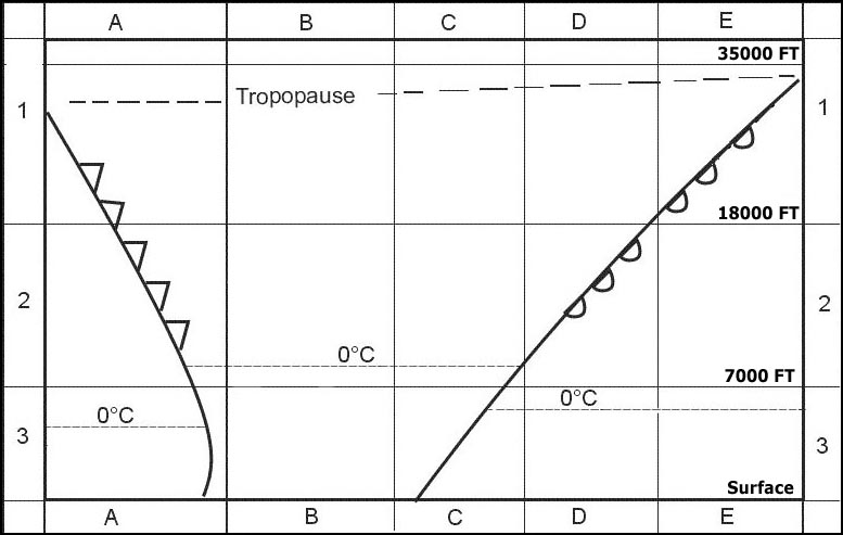
Question 155-1 : The cloud type most applicable to square 1e is . 332 ? [ MCQ aircraft ]

Cs

exemple 255 Cs.

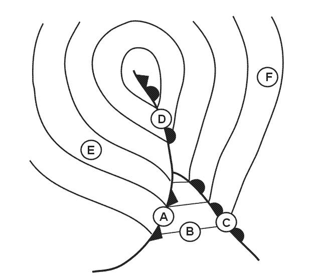
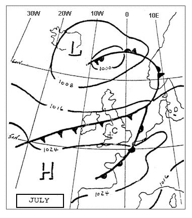
Question 155-2 : The front at the bottom of the diagram south of position c is . 333 ?

An occlusion on the surface

Admin . 613 exemple 259 An occlusion on the surface.

Question 155-3 : The weather most likely to be experienced at position 'b' is . 334 ?

Frequent showers of rain or snow good visibility outside showers

Admin .a cold front has passed over position 'b' few hours ago we are in the cold sector behind the cold front . 614.in the weather pattern behind a cold front the visibility outside precipitation is good and the precipitation is showers exemple 263 Frequent showers of rain or snow, good visibility outside showers

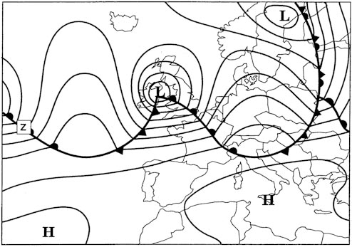
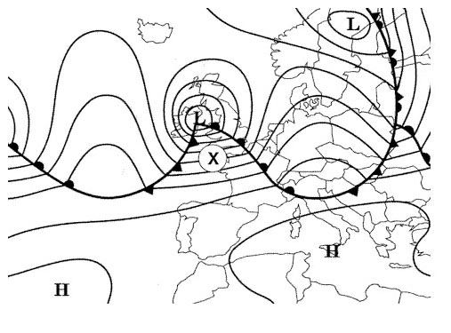
Question 155-4 : The air mass at position 'x' is most likely to be . 335 ?

Maritime tropical
Admin .regarding the overall mass movement the air mass is coming from the ocean the isobars in the warm sector give an indication in the direction of the system until it occludes . 623.a large body of air will have the characteristics of its origin the source region particulary with regard to moisture and temperature in that a mass of air can originate from tropical or polar regions be warm or cold or be maritime or polar wet or dry exemple 267 Maritime tropical.

Question 155-5 : The weather most likely to be experienced near to position 'a' is . 336 ?

Frequent showers of rain and snow good visibility outside precipitation

Admin .a cold front has passed over position 'a' few hours ago we are in the cold sector behind the cold front . 614.in the weather pattern behind a cold front the visibility outside precipitation is good and the precipitation is showers exemple 271 Frequent showers of rain and snow, good visibility outside precipitation.

Question 155-6 : For an aircraft making an approach to an airfield located in square 3b away from the vicinity of the fronts the most likely weather conditions in winter are . 337 ?

Poor visibility in mist and drizzle

Admin . 622.in summer we could expect scattered sc and cu with good visibility in winter the cloud base would remain low over the land we gonna have poor visibility in mist and drizzle exemple 275 Poor visibility in mist and drizzle.

Question 155-7 : For an aircraft making an approach to an airfield located in square 3b the most likely weather conditions are . 338 ?

Low cloud mist

Admin .this is the warm sector . 622.once the warm front passes your location you will notice an increase in temperature and air pressure as the warm sector moves into your location you will notice an increase in the humidity of the air exemple 279 Low cloud, mist.

Question 155-8 : What flight conditions are most likely to be experienced in square 2b by an aircraft at fl 120 . 337 ?

Vmc above layers of st and sc generally stable conditions
Admin .in the middle of the warm sector we would expect to experience typical tropical maritime conditions .low stratus poor visibility and drizzle at the surface but at fl120 without frontal lifting action the aircraft would be in clear stable air and above the cloud layers .the magic drawing . 622.each question asking for weather in square 2b offer four different possible answers .in square 2b you can be in the cb or above the stratus located in square 3b in clear and stable conditions .you will not have a question with the two answers available exemple 283 Vmc above layers of st and sc, generally stable conditions.

Question 155-9 : The cloud type most applicable to most of square 3b is . 337 ?

Sc

Admin . 622.square 3b is from surface to fl70 in this square you can not find any cirrostratus cs high level cloud or altostratus as medium level cloud .you are in the middle of the warm sector in winter you will have stratus in summer the cloud may lift to give stratoscumulus sc low level cloud exemple 287 Sc.

Question 155-10 : For 1300 utc select a metar which you consider to be most appropriate to position 't' . 341 ?

19010kt 6000 ra bkn016 ovc090 08/06 q1004=
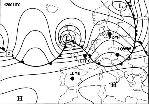
Lasanowc .i don't understand why this answer .as i can see the wind which blows along the isobars comes approximately from 240 .the difference between ovc090 and bkn100 is neglibile i think . .it's a good investigation .but from the isobars the wind comes from 220° .in northern hemisphere at mid latitude over land wind speed in friction layer decrease by 50% the wind in the friction layer blows across the isobars towards the low pressure angle between wind direction and isobars changes by 30° .220° 30° = 190° .there would be low stratus bkn016 and moderate visibility with rain the inclined plane of a warm front is 1/150 and the cloud coverage is very compact ovc . 615.warm front cross section exemple 291 19010kt 6000 ra bkn016 ovc090 08/06 q1004=

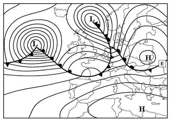
Question 155-11 : The front labelled 'e' is a . 343 ?

Cold front

exemple 295 Cold front.

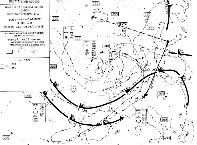
Question 155-12 : The front located from 10°w to 10°e is most likely to be . 344 ?

A quasi stationary front

exemple 299 A quasi-stationary front.

Question 155-13 : From indications shown on the chart when front 's' passes position 'v' the surface wind should . 348 ?

Veer and remain more or less at the same speed

Admin .the isobars ahead of and behind the front are parallel and almost straight the surface wind will not change significantly since the isobars remain at the same spacing in the northern hemisphere on the passage of a front the wind will veer change direction clockwise . 567 exemple 303 Veer and remain more or less at the same speed.

Question 155-14 : When front 'g' passes position 't' the surface wind should . 350 ?

Veer and increase

Admin . 567.we know that the wind turns counterclockwise around a low pressure but at position 't' the surface wind veers turn clockwise and increases because the isobars after front g are very close together means stronger wind exemple 307 Veer and increase

Question 155-15 : What conditions are most likely to prevail at an aerodrome located in square 3b . 351 ?

6 8 oktas sc and st visibility moderate to poor in drizzle

exemple 311 6 - 8 oktas sc and st, visibility moderate to poor in drizzle

Question 155-16 : For an aircraft at fl 80 ahead of the front in square 2d the expected flight conditions are . 351 ?

Below as type cloud generally smooth air with light precipitation

Admin . 619. 622.you are below as type cloud there is usually no thunderstorms ahead of a warm front but a possibility of light precipitation .there might be light to moderate turbulence on the front but not ahead of the front the sky is overcast exemple 315 Below as type cloud, generally smooth air with light precipitation.

Question 155-17 : The air mass type indicated by arrow number 4 is designated . 352 ?

Maritime tropical

Admin . 623 exemple 319 Maritime tropical.

Question 155-18 : The weather most likely to be experienced at position a is . 353 ?

Mainly overcast with stratus or stratocumulus and drizzle medium to strong winds
Admin .position a is located between a warm front and a cold front this is the warm sector . 622.in summer we could expect scattered sc and cu with good visibility in winter the cloud base would remain low over the land we could expect poor visibility in mist and drizzle stratus and/or stratocumulus exemple 323 Mainly overcast with stratus or stratocumulus and drizzle, medium to strong winds

Question 155-19 : The widest precipitation zone occurs usually ?

Ahead of a warm front

Admin . 622.the question is not asking about the strongest precipitation but only the widest precipitation zone exemple 327 Ahead of a warm front.

Question 155-20 : The slope and speed of a warm front compared to the slope and speed of a cold front is in general ?

Smaller and slower

Admin . 621 exemple 331 Smaller and slower.

Question 155-21 : The air mass affecting position 'a' is most likely to be . 354 ?

Maritime polar

Admin . 623 exemple 335 Maritime polar.

Question 155-22 : The air mass affecting position 'r' is most likely to be . 358 ?

Maritime polar

Admin .a polar maritime air mass originates over the northern part of the north atlantic ocean it is unstable cool and moist air and can produce anything from cumulus to cumulonimbus with showers and sunny spells in between . 623 exemple 339 Maritime polar.

Question 155-23 : The air mass affecting position 'c' is most likely to be . 359 ?

Maritime tropical

Admin . 623.a large body of air will have the characteristics of its origin the source region particulary with regard to moisture and temperature in that a mass of air can originate from tropical or polar regions be warm or cold or be maritime or polar wet or dry exemple 343 Maritime tropical.

Question 155-24 : During the passage of a front in the northern hemisphere the wind veers this statement is ?

True

Admin . 567.ahead of a warm front in northern hemisphere as ahead of a cold front the wind veers in the friction layer and veers above the friction layer exemple 347 True.

Question 155-25 : In the northern hemisphere advection of warm air aloft indicates ?

The approach of a warm occlusion

Admin .with a warm occlusion cold front rides up and over the warm front . 626.advection = horizontal movement .in a warm occlusion the wedge of warm air from a warm sector depression is pushed up by the fast moving cold front and carried along aloft as the depression moves exemple 351 The approach of a warm occlusion.

Question 155-26 : An air mass is ?

An extensive body of air within which the temperature and humidity in horizontal planes are practically uniform

exemple 355 An extensive body of air within which the temperature and humidity in horizontal planes are practically uniform.

Question 155-27 : A stationary front is a front in which ?

There is no horizontal motion perpendicular to the front

exemple 359 There is no horizontal motion perpendicular to the front.

Question 155-28 : An air mass acquires its basic properties ?

By stagnation of the air for a long period of time over areas having particular characteristics

exemple 363 By stagnation of the air for a long period of time over areas having particular characteristics

Question 155-29 : An occlusion is called a warm occlusion when the cold air ?

At the rear of the occlusion is less cold than the cold air ahead with the warm air at a higher altitude

Admin .with a warm occlusion cold front rides up and over the warm front we have cool air behind and cold air ahead . 626.in a warm occlusion the wedge of warm air from a warm sector depression is pushed up by the fast moving cold front and carried along aloft as the depression moves exemple 367 At the rear of the occlusion is less cold than the cold air ahead, with the warm air at a higher altitude.

Question 155-30 : At a cold front ?

Warm air is lifted as cooler air pushes under it

Admin . 621.at a cold front the cold air pushes the warm air up warm air is lifted exemple 371 Warm air is lifted as cooler air pushes under it.

Question 155-31 : At a station at the surface the significant weather with a warm front will come ?

Mostly before the front passes

Admin . 505.the question is asking about what happens at the surface only .the active weather low cloud and continuous rain is ahead of the surface position of the front and the frontal rain stops when the front passes through the surface position exemple 375 Mostly before the front passes.

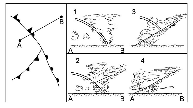
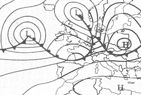
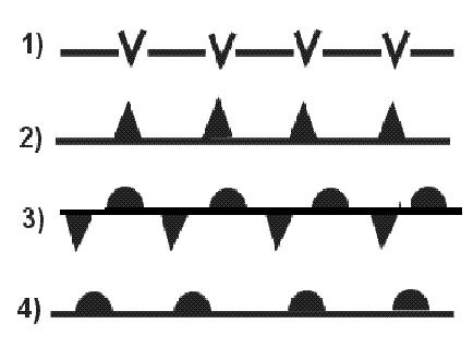
Question 155-32 : The diagram of the system represents a . 362 ?

Warm occlusion

Admin .if the warm frontal surface contacts the ground it's a warm occlusion . 628 exemple 379 Warm occlusion.

Question 155-33 : The warm sector is indicated by number . 364 ?

3

exemple 383 3.

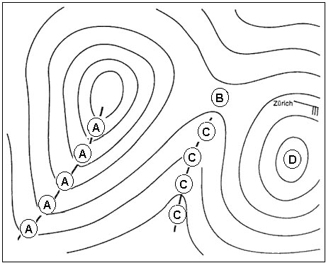
Question 155-34 : A convergence line is indicated by number . 364 ?

1

exemple 387 1.

Question 155-35 : In which air mass are extremely low temperatures encountered ?

Continental polar air

Admin .the lowest temperature is found within the continental polar region because russia where the continental polar region is located is far way from any sea and ocean for this reason it is very cold and dry exemple 391 Continental polar air.

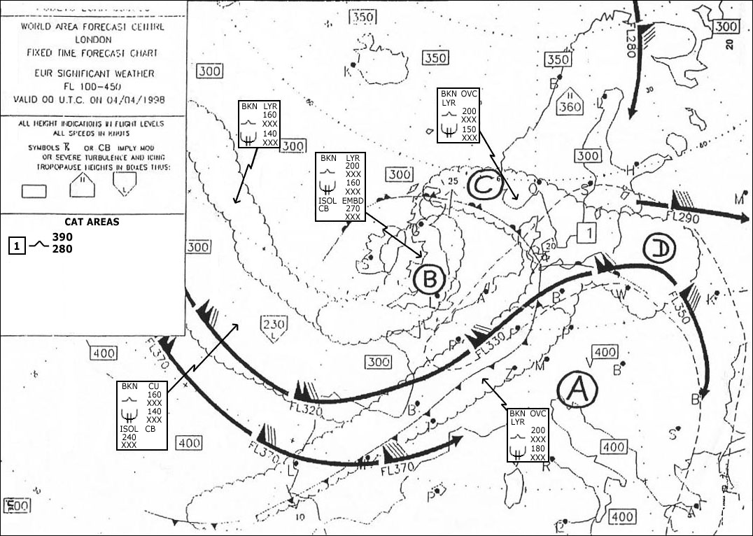
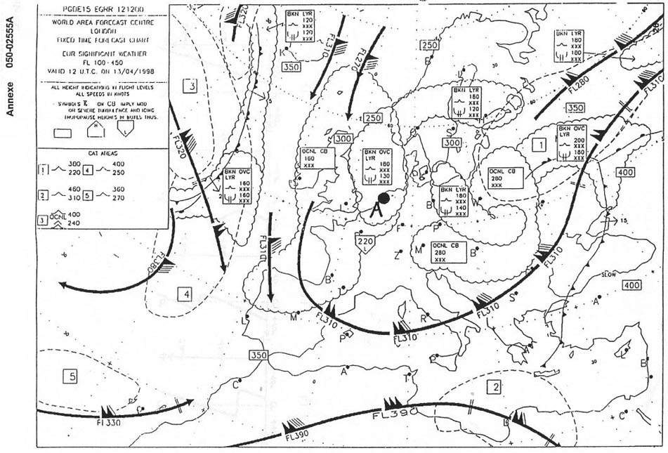
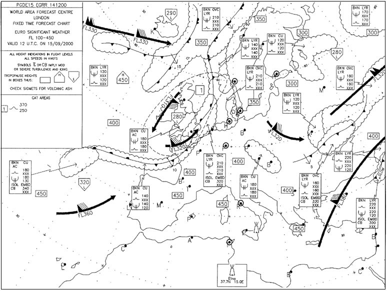
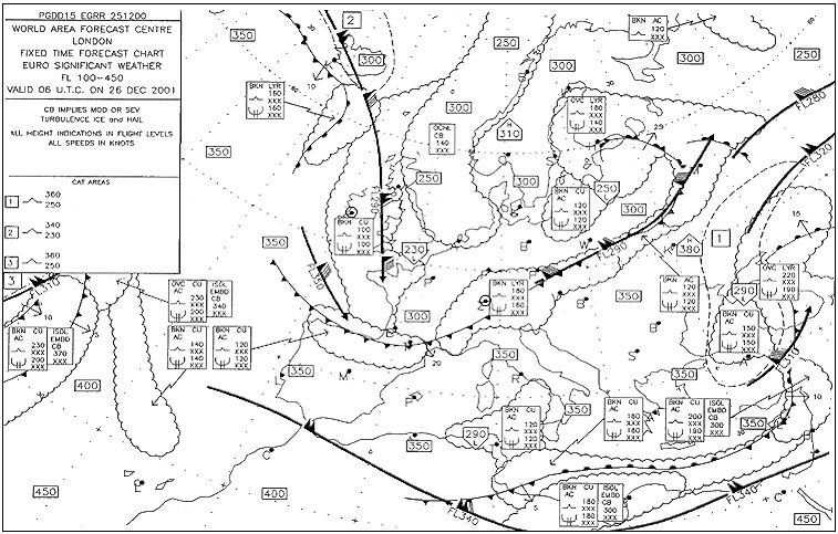
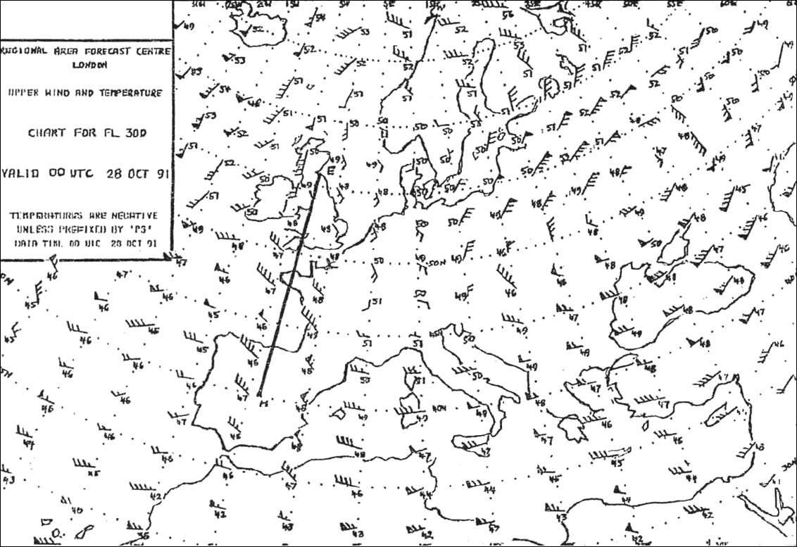
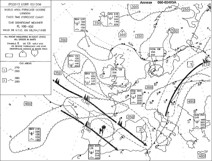
Question 155-36 : At lyon lfly n4545 e00500 at 1200 utc the sky is overcast with stratocumulus and altostratus and it is raining .using the swc in appendix valid at 1200 utc we can estimate a weather improvement for lyon . 369 ?

2100 utc

A cold front is currently over lfly travelling at 10 kt as indicated by the arrow and '10' we have to wait for the aera behind this front to have a weather improvement .it will take between 6h to 10 hours the answer '2100 utc' sounds perfect exemple 395 2100 utc.

Question 155-37 : The following sequence of clouds is observed at an airport cirrus cirrostratus altostratus nimbostratus this is typical for ?

The passage of a warm front

Img505 exemple 399 The passage of a warm front.

Question 155-38 : The average slope of a cold front is in the order of ?

Of 1 80

exemple 403 Of 1:80.

Question 155-39 : The average position of the polar front in the northern hemisphere is ?

More southerly during the winter than during the summer
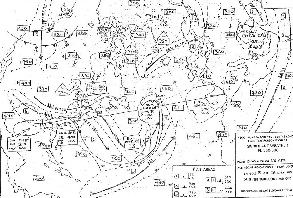
The polar front is the boundary between polar air and tropical air .during the winter months in the northern hemisphere the polar front pushes farther southward because of the greater density of the polar air than during the summer months .in winter the mean position of the polar front extends from florida to sw england exemple 407 More southerly during the winter than during the summer.

Question 155-40 : The arctic front is the boundary between ?

Polar air and arctic air

exemple 411 Polar air and arctic air.


~

Exclusive rights reserved. Reproduction prohibited under penalty of prosecution.

6159 Free Training Exam