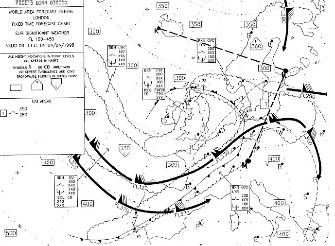
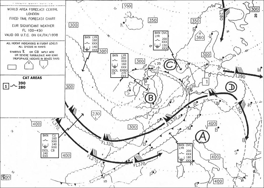
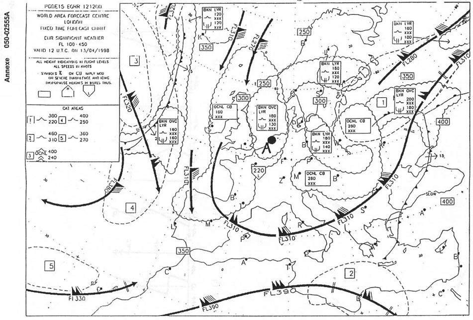
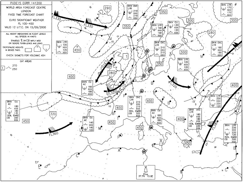
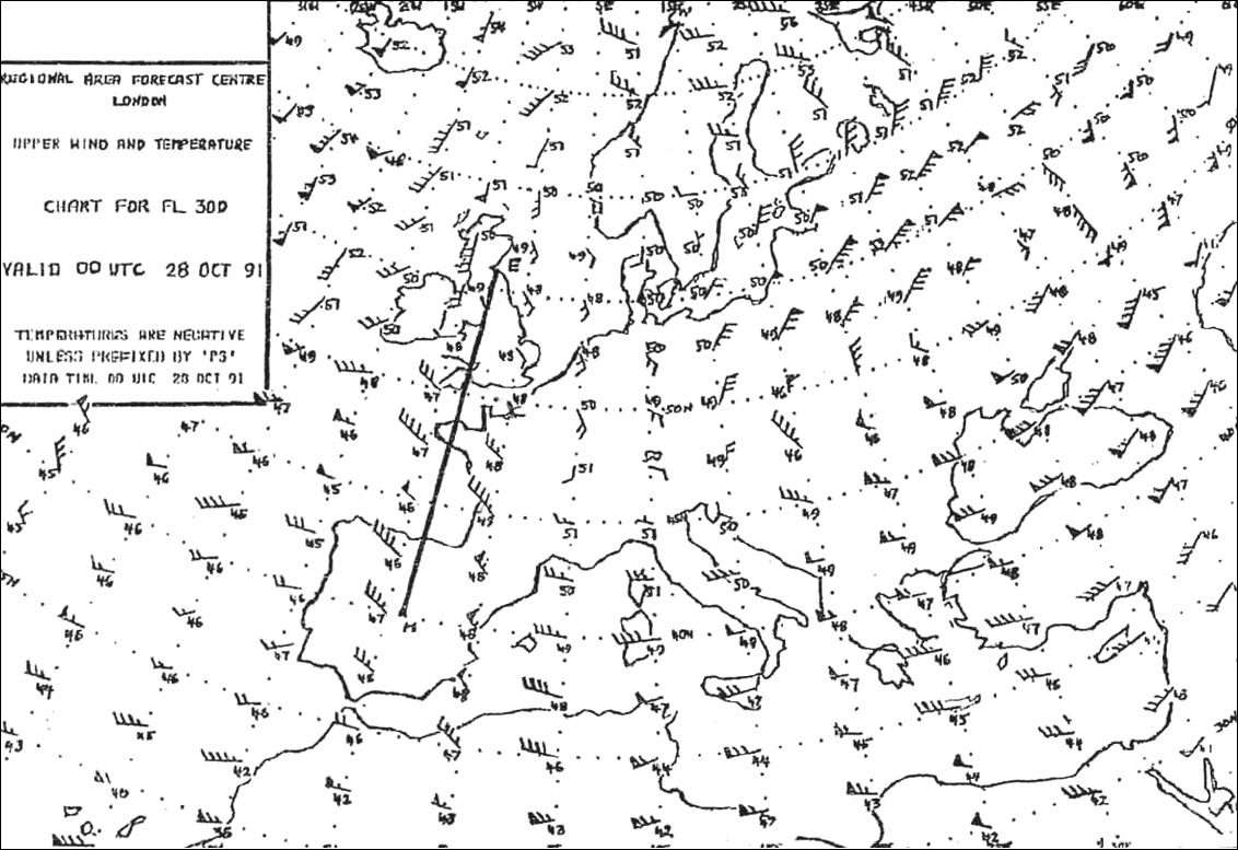
Which typical weather condition is shown by the design for the area of central ? [ MCQ aircraft ]
Question 155-1 : Westerly waves cutting wind easterly waves uniform pressure pattern
 Westerly waves.
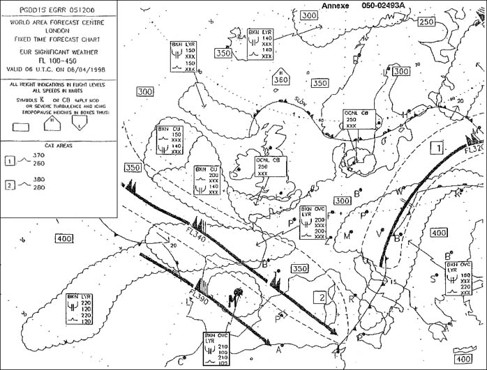
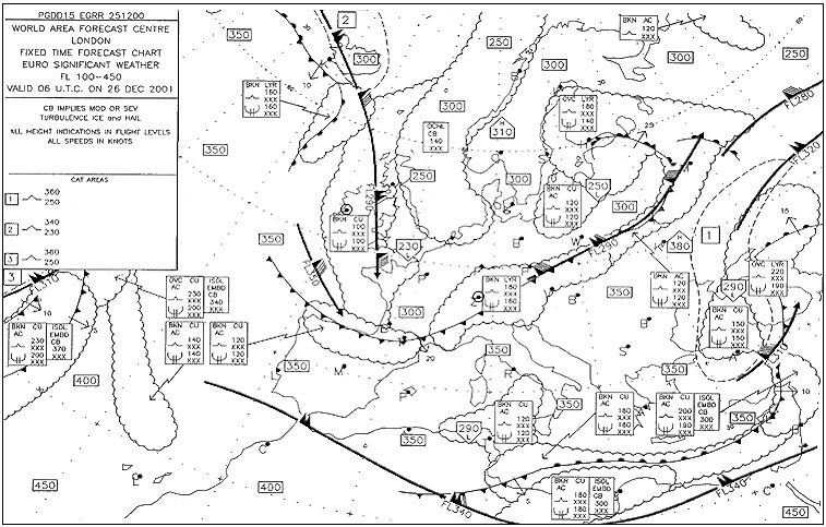
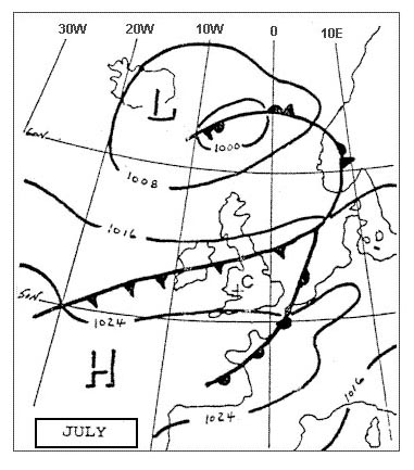
 Which typical weather condition is shown by the design for northern italy . 316 ?
Question 155-2 : High pressure warm southerly wind westerly wind easterly wind
 High pressure.
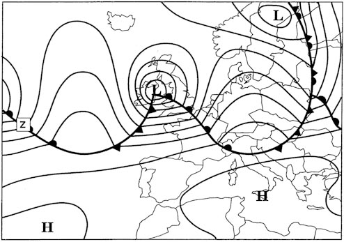
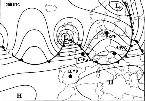
 The attached chart shows the weather conditions on the ground at 1200 utc on ?
Question 155-3 : Taf lszh 101500z 1016/1101 vrb02kt 8000 nsc becmg 1016/1018 3500 mifg becmg 1018/1020 1500 bcfg becmg 1020/1022 0100 fg vv001= taf lszh 101500z 1016/1101 23012kt 6000 ra bkn012 ovc030 tempo 1020/1023 22025g40kt 1600 +snra bkn003 ovc015= taf lszh 101500z 1016/1101 32008kt 9999 sct030tcu tempo 1022/1101 32020g32kt 3000 tsra bkn020cb= taf lszh 101500z 1016/1101 05020g35kt 8000 bkn015 tempo 1017/1020 05018kt 0300 +shsn vv002=
 Taf lszh 101500z 1016/1101 vrb02kt 8000 nsc becmg 1016/1018 3500 mifg becmg 1018/1020 1500 bcfg becmg 1020/1022 0100 fg vv001=
 You are flying from east to west in the northern hemisphere at the 500 hpa ?
Question 155-4 : If the wind is from the north you are gaining altitude if the wind is from the south you are gaining altitude if you have a head wind you are gaining altitude if you have a tail wind you are losing altitude
 If the wind is from the north you are gaining altitude.
 Divergence in the upper air results near the surface in ?
Question 155-5 : Falling pressure and likely formation of clouds rising pressure and likely dissipation of clouds falling pressure and likely dissipation of clouds rising pressure and likely formation of clouds
 Falling pressure and likely formation of clouds.
 In a low pressure system the convergence at the surface is caused by ?
Question 155-6 : Frictional forces centripetal forces the inbalance of the horizontal gradient force and the coriolis force the curvature of the isobars
 Frictional forces.
 If the pressure surfaces bulge upwards in all levels then the pressure system ?
Question 155-7 : Warm high cold low cold high warm low
 Warm high.
 A cold air pool ?
Question 155-8 : Is usually most evident in the circulation and temperature fields of the middle troposphere and may show little or no sign on a surface chart develops usually in winter when very unstable maritime polar or maritime arctic air currents stream southwards along the eastern side of an extensive ridge of high pressure in association with occluded systems normally disappears at night and occurs almost exclusively in summer occurs frequently in winter to the south of the alps when this region is under the influence of cold north westerly airstream
 Is usually most evident in the circulation and temperature fields of the middle troposphere and may show little or no sign on a surface chart
 The stable layer at some height in the low troposphere of an older high ?
Question 155-9 : Subsidence inversion friction inversion radiation inversion trade wind inversion
 Subsidence inversion.
 A blocking anticyclone in the northern hemisphere is ?
Question 155-10 : A warm anticyclone quasi stationary situated between 50°n and 70°n quasi stationary situated between 50°n and 70°n a cold anticyclone situated between 50°n and 70°n a cold anticyclone steering depressions a cold anticyclone steering depressions situated over scandinavia
 A warm anticyclone, quasi stationary, situated between 50°n and 70°n.
 Which statement is true for hurricanes in the north atlantic ?
Question 155-11 : From the earth's surface up to the tropopause the core is warmer than its surroundings they intensify rapidly after landfall the diameter is 50 500 m their greatest frequency of occurrence is in winter
 From the earth's surface up to the tropopause the core is warmer than its surroundings.
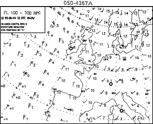
 Assume that an aircraft is flying in the northern hemisphere at the 500 hpa ?
Question 155-12 : If in this pressure surface the wind comes from the direction 360 degrees then true altitude is increasing if in this pressure surface the wind comes from the direction 180 degrees then true altitude is increasing if in this pressure surface the wind comes from the direction 270 degrees then true altitude is increasing if in this pressure surface the wind comes from the direction 090 degrees then true altitude is increasing
 If in this pressure surface the wind comes from the direction 360 degrees, then true altitude is increasing.
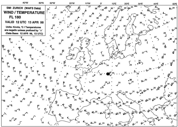
 An aircraft is flying at fl 180 in the northern hemisphere with a crosswind ?
Question 155-13 : It decreases it increases it remains constant without knowing temperatures at fl 180 this question can not be answered
 It decreases.
 Which of the following is true concerning an aircraft that is flying at fl180 ?
Question 155-14 : There is no cross wind there is a cross wind from the left there is a cross wind from the right without knowing temperature at fl 180 this question can not be answered
 There is no cross wind.
 The reason for the fact that the atmospheric pressure of a polar front ?
Question 155-15 : The temperature contrasts between arctic and equatorial areas are much greater in winter the low pressure activity of the sea east of canada is higher in winter the strong winds of the north atlantic in winter are favourable for the development of lows converging air currents are of greater intensity in winter
 The temperature contrasts between arctic and equatorial areas are much greater in winter.
 In which of the following areas do surface high pressure systems usually ?
Question 155-16 : Azores se usa sw europe greenland azores ne canada iceland sw usa azores greenland sw europe ne canada
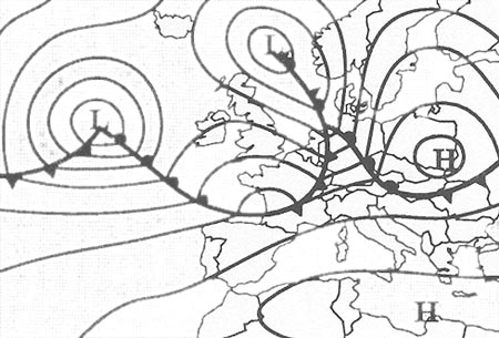 Azores, se usa, sw europe.
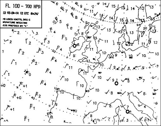
 In the northern hemisphere with an anticyclonic pressure system the geostrophic ?
Question 155-17 : 340°/20 kt 030°/20 kt 340°/28 kt 030°/28 kt
 340°/20 kt.
 Select the answer which you consider will complete correctly the following ?
Question 155-18 : Iceland / greenland usa siberia azores
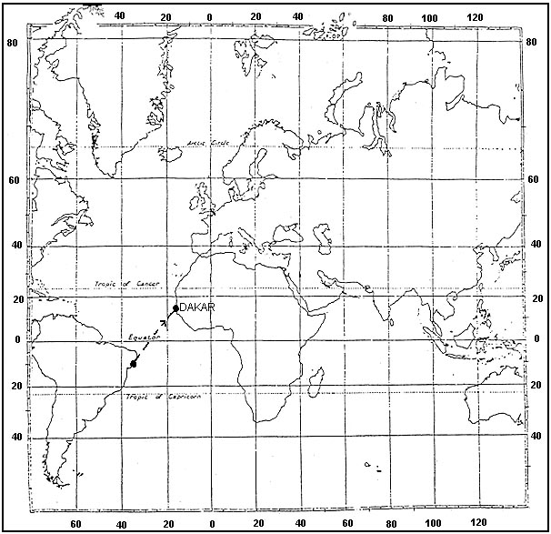 Iceland / greenland.
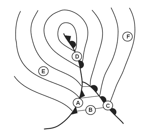
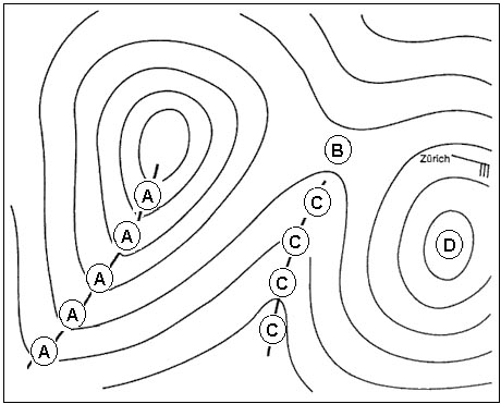
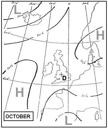
 The pressure system at position 'd' is . 319 ?
Question 155-19 : A col a secondary low a trough of low pressure a ridge of high pressure
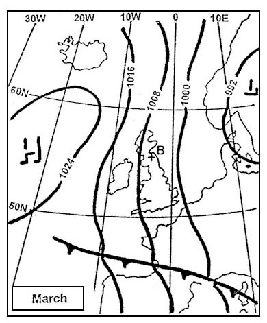 A col.
 Considering the north atlantic region between 30°n and 65°n and the adjacent ?
Question 155-20 : Azores high and weak low over ne canada scandinavian high and azores high weak low over ne canada and scandinavian high azores low and icelandic high
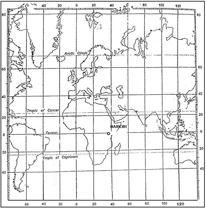 Azores high and weak low over ne canada.
 Considering the north atlantic region between 30°n and 65°n together with the ?
Question 155-21 : Azores siberia siberia iceland canaries ne canada iceland greenland iberian peninsula
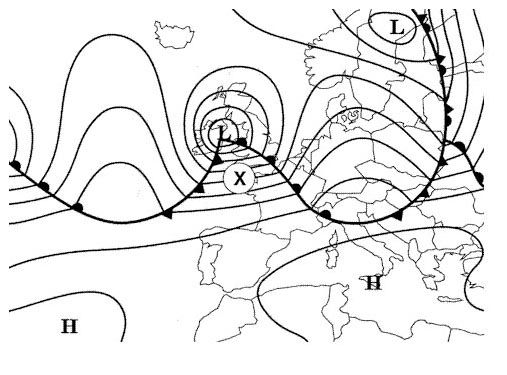 Azores, siberia.
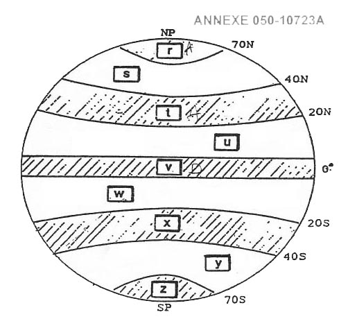
 The arrows labelled 'r' represent the mean tracks of tropical revolving storms ?
Question 155-22 : December to april and are called cyclones december to april and are called tornadoes june to october and are called typhoons june to october and are called hurricanes
 December to april and are called cyclones
 Which is true of a secondary depression in the northern hemisphere ?
Question 155-23 : It tends to move round the primary in a cyclonic sense it tends to move round the primary in an anticyclonic sense it rapidly closes on and merges with the primary it tends to maintain its position relative to the primary
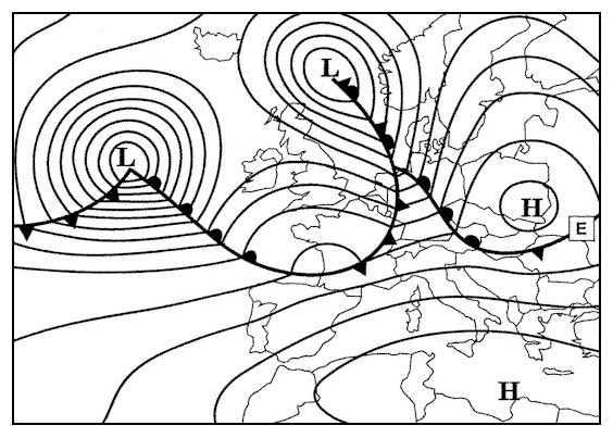 It tends to move round the primary in a cyclonic sense.
 The arrows labelled 's' represent the mean tracks of tropical revolving storms ?
Question 155-24 : May to november and are called cyclones december to april and are called cyclones may to november and are called hurricanes december to april and are called typhoons
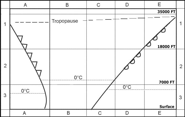 May to november and are called cyclones.
 The arrows labelled 't' represents the mean track of tropical revolving storms ?
Question 155-25 : June to october and are called cyclones december to april and are called hurricanes june to october and are called tornadoes june to october and are called hurricanes
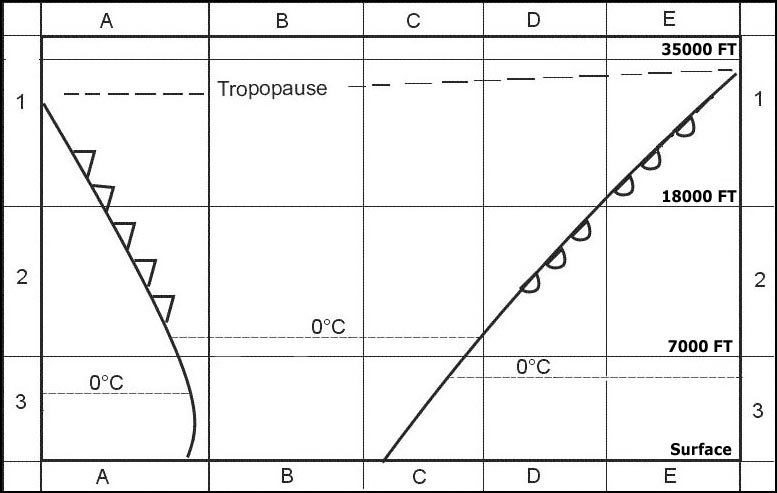 June to october and are called cyclones.
 The arrows labelled 'u' represent the tracks of tropical revolving storms which ?
Question 155-26 : July to october and are called typhoons january to march and are called willy willies may to july and are called cyclones december to april and are called tornadoes
 July to october and are called typhoons.
 When if at all is a tropical revolving storm most likely to affect darwin on ?
Question 155-27 : December to april may to july august to october not experienced at darwin
 December to april.
 A trough of low pressure on a surface synoptic chart is an area of ?
Question 155-28 : Convergence and widespread ascent divergence and subsidence divergence and widespread ascent convergence and subsidence
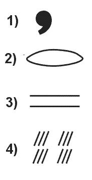 Convergence and widespread ascent.
 Which is true of a typical non frontal thermal depression ?
Question 155-29 : It forms over land in summer it forms over the ocean in summer it forms over the ocean in winter it forms over land in winter
 It forms over land in summer.
 During summer an anticyclone covers the british isles giving mainly clear skies ?
Question 155-30 : Become southerly to southwesterly and increase in velocity by afternoon back to nw and strengthen by mid afternoon increase from the north by mid morning becoming calm towards evening veer to easterly before becoming calm by the afternoon
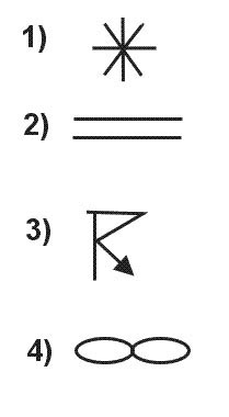 Become southerly to southwesterly and increase in velocity by afternoon.
 During summer a weak pressure gradient covers a coastal airfield in eastern ?
Question 155-31 : Easterly to southeasterly and increase in velocitiy by afternoon easterly and then westerly by afternoon westerly and increase in velocity by afternoon westerly and then southerly by evening
 Easterly to southeasterly and increase in velocitiy by afternoon.
 For the same horizontal distance between adjacent isobars the gradient wind ?
Question 155-32 : 50°n with a cyclonic circulation 50°n in an anticyclone 30°n with a cyclonic circulation 30°n in an anticyclone
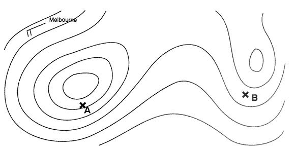 50°n with a cyclonic circulation.
 Over which areas can tropical cyclones occur ?
Question 155-33 : Caribbean sea gulf of bengal indian ocean east of madagascar india arabic sea atlantic ocean at 2°s australia gulf of bengal atlantic ocean at 20°s caribbean sea indian ocean at 20°s pacific ocean at 2°n
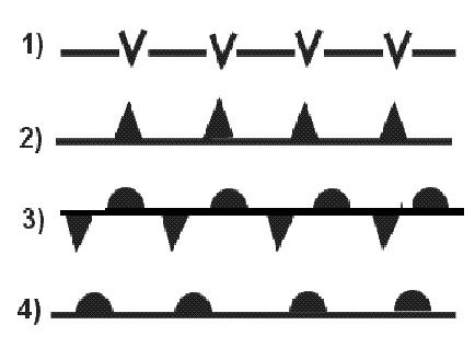 Caribbean sea, gulf of bengal, indian ocean east of madagascar.
 The hurricane season in the caribbean is mainly from ?
Question 155-34 : July until november october until january january until april april until july
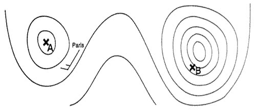 July until november.
 Which statement about hurricanes in the north atlantic is correct ?
Question 155-35 : Their eye can be well observed by weather satellites they intensify after landfall they move towards the equator they move with a speed of at least 60 kt
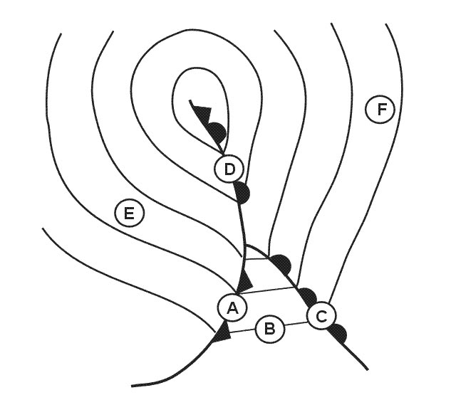 Their eye can be well observed by weather satellites
 You are flying at fl 340 250 hpa on the northern hemisphere .the wind is ?
Question 155-36 : Increase decrease decrease only if the pressure at the surface is decreasing on your route increase only if the temperature at your flight level is rising on your route
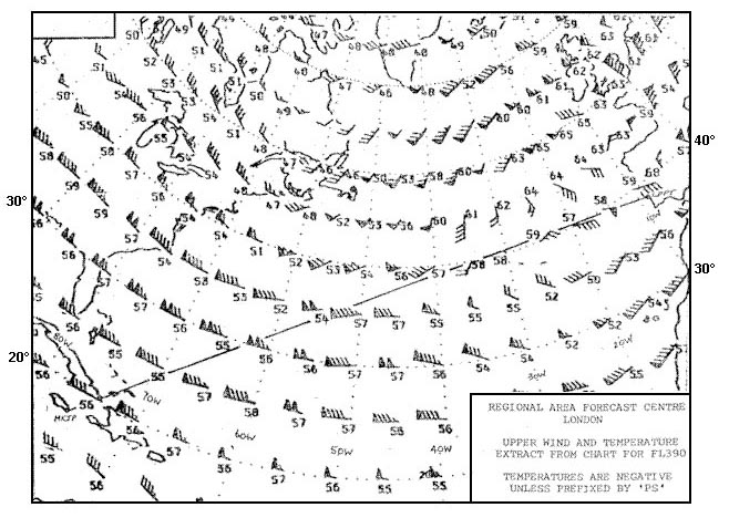 Increase.
 You are flying in the northern hemisphere at 2000 ft over a flat country area ?
Question 155-37 : From your right from your left from ahead from behind
 From your right.
 Why do tropical revolving storms tend to develop mostly in the western parts of ?
Question 155-38 : Because there is a maximum of humidity as a result of the trade winds long sea passage because they are areas in which there is a strong progressive wind shear with increase of height because there is a maximal temperature difference between land mass and sea because the gulf formation of the coastlines triggers a strong rotary circulation
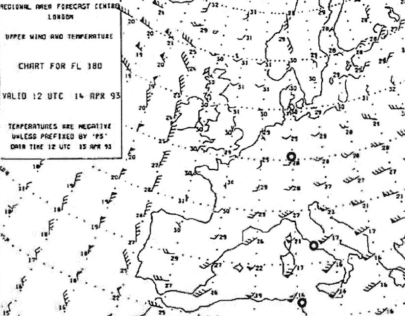 Because there is a maximum of humidity as a result of the trade winds long sea passage
 Over the indian ocean and the bay of bengal tropical cyclones are ?
Question 155-39 : Occasionally observed in the average 12 per year rare in the average one every two years never observed frequently observed in the average 15 per year over the indian ocean but never over the bay of bengal
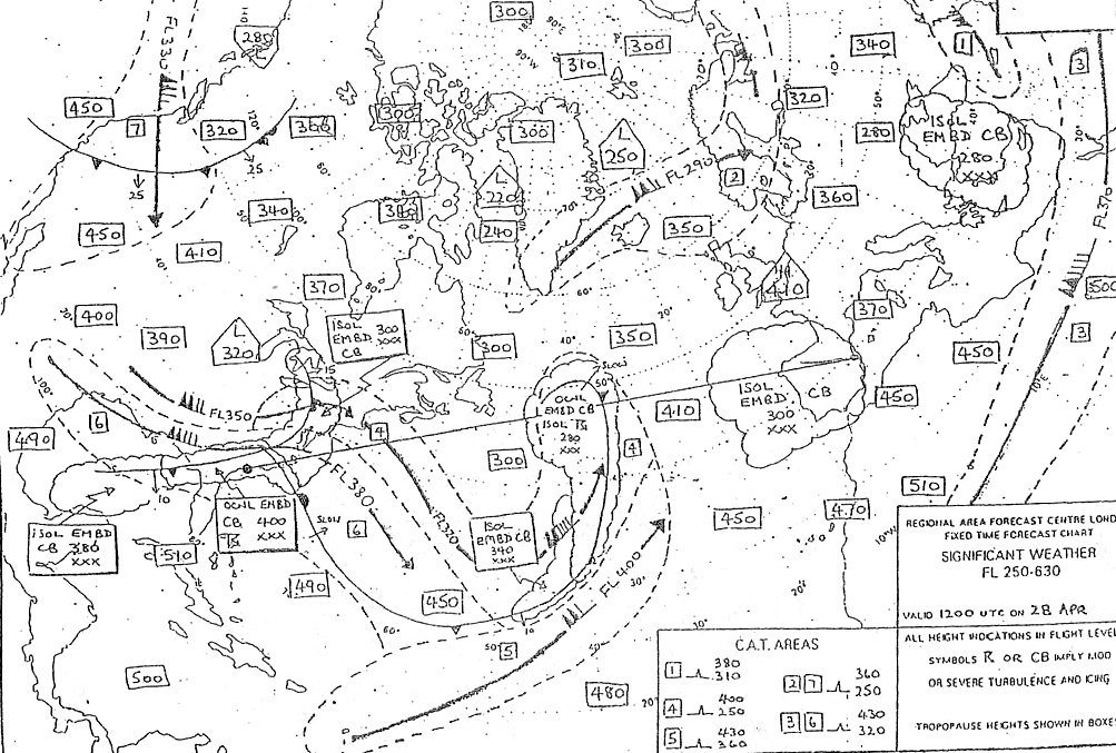 Occasionally observed, in the average 12 per year.
 Tropical revolving storms are not formed in ?
Question 155-40 : South atlantic ocean gulf of bengal waters around the philippines south indian ocean
 South atlantic ocean.
 ~
Exclusive rights reserved. Reproduction prohibited under penalty of prosecution.
6159 Free Training Exam
