A free Premium account on the FCL.055 website! Read here
Sign up to unlock all our services and 15164 corrected and explained questions.
Question 171-1 : Which of the following is true concerning an aircraft that is flying at fl180 in the northern hemisphere where wind is geostrophic and the true altitude remains constant ? [ Practice protocol ]
There is no cross wind
Question 171-2 : The reason for the fact that the atmospheric pressure of a polar front depression is normally lower in winter than in summer is that ?
The temperature contrasts between arctic and equatorial areas are much greater in winter.
The warm air is fairly consistent throughout the year but the cold air is much colder in the winterThe low pressure activity of the sea east of canada is higher in winter. the strong winds of the north atlantic in winter are favourable for the development of lows. converging air currents are of greater intensity in winter.
Question 171-3 : In which of the following areas do surface high pressure systems usually predominate over the north atlantic region between 30°n and 65°n and the adjoining land areas during the northern summer ?
Azores se usa sw europe.
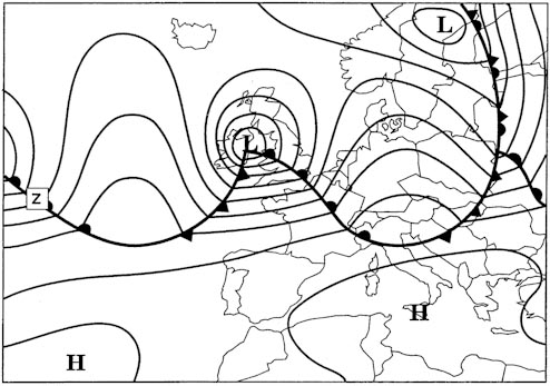
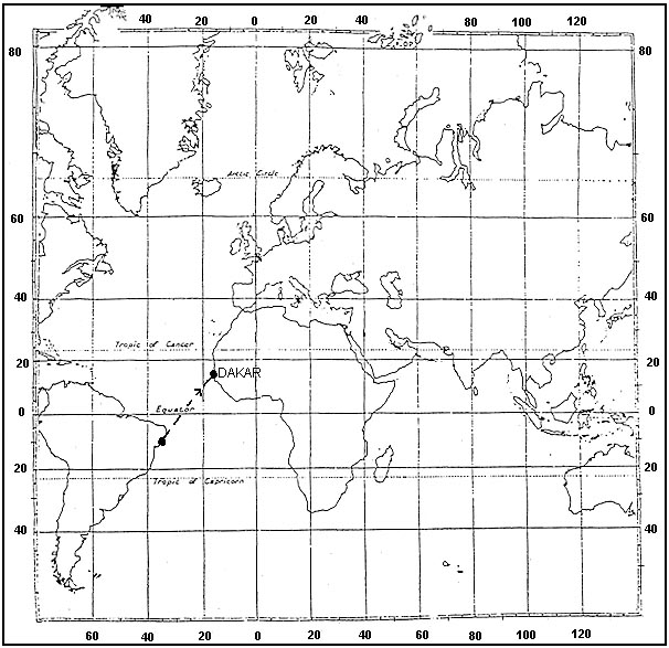
From winter to summer the polar front over the north atlantic moves towards the north 598between 30°n and 65°n in winter low pressure systems centered over iceland greenland high pressure systems centered over azores siberia the polar front extends from florida to sw englandbetween 30°n and 65°n in summer low pressure systems centered over ne canada high pressure systems centered over azores se usa sw europe the polar front extends from newfoundland to n scotlandGreenland, azores, ne canada. iceland, sw usa, azores. greenland, sw europe, ne canada.
Question 171-4 : In the northern hemisphere with an anticyclonic pressure system the geostrophic wind at 2000 ft over the sea is 350°24 ktat the same position the surface wind is most likely to be ?
340°20 kt.
Values to be used in examinations over sea wind speed in friction layer decrease by 30% the wind in the friction layer blows across the isobars towards the low pressure angle between wind direction and isobars changes by 10°over land wind speed in friction layer decrease by 50% the wind in the friction layer blows across the isobars towards the low pressure angle between wind direction and isobars changes by 30°the wind blows parallel to the isobars and in the northern hemisphere the surface wind will back and slowdown compared to it030°/20 kt. 340°/28 kt. 030°/28 kt.
Question 171-5 : Select the answer which you consider will complete correctly the following statement in relation to the main pressure systems affecting the north atlantic region between 30°n and 65°nduring winter the predominant mean low pressure system at the surface ?
Iceland greenland.
From summer to winter the polar front over the north atlantic moves towards the south 585between 30°n and 65°n in winter low pressure systems centered over iceland greenland high pressure systems centered over azores siberia the polar front extends from florida to sw englandbetween 30°n and 65°n in summer low pressure systems centered over ne canada high pressure systems centered over azores se usa sw europe the polar front extends from newfoundland to n scotlandUsa. siberia. azores.
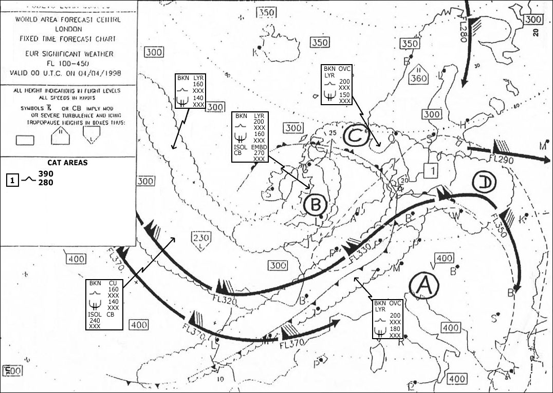
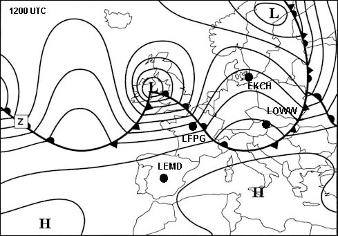
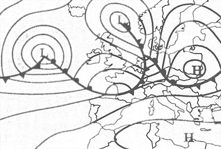
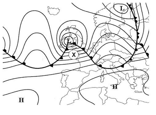
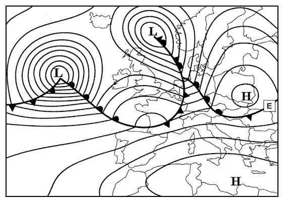
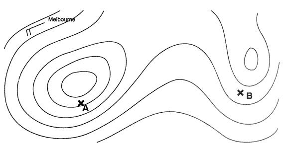
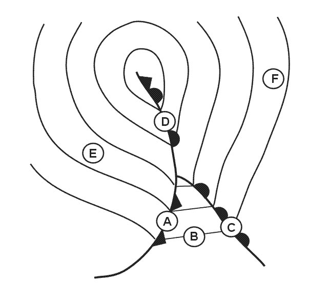
Question 171-6 : The pressure system at position 'd' is 319 ?
A col.
A col is an area of almost uniform pressure between two highs and two lows no isobars define its boundary 586A secondary low. a trough of low pressure. a ridge of high pressure.
Question 171-7 : Considering the north atlantic region between 30°n and 65°n and the adjacent land areas during mid summer the predominant pressure systems are ?
Azores high and weak low over ne canada.
From winter to summer the polar front over the north atlantic moves towards the north 598between 30°n and 65°n in winter low pressure systems centered over iceland greenland high pressure systems centered over azores siberia the polar front extends from florida to sw englandbetween 30°n and 65°n in summer low pressure systems centered over ne canada high pressure systems centered over azores se usa sw europe the polar front extends from newfoundland to n scotlandScandinavian high and azores high. weak low over ne canada and scandinavian high. azores low and icelandic high.
Question 171-8 : Considering the north atlantic region between 30°n and 65°n together with the adjacent land areas during winter the normal disposition of the main anticyclones at the surface is ?
Azores siberia.
From summer to winter the polar front over the north atlantic moves towards the south 585between 30°n and 65°n in winter low pressure systems centered over iceland greenland high pressure systems centered over azores siberia the polar front extends from florida to sw englandbetween 30°n and 65°n in summer low pressure systems centered over ne canada high pressure systems centered over azores se usa sw europe the polar front extends from newfoundland to n scotlandSiberia, iceland, canaries. ne canada, iceland. greenland, iberian peninsula.
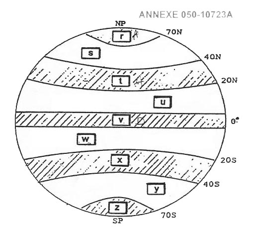
Question 171-9 : The arrows labelled 'r' represent the mean tracks of tropical revolving storms which occur mainly from 320 ?
December to april and are called cyclones.
December to april and are called tornadoes june to october and are called typhoons june to october and are called hurricanes
Question 171-10 : Which is true of a secondary depression in the northern hemisphere ?
It tends to move round the primary in a cyclonic sense.
Wave depressions can grow off the tail ends of primary cold fronts the depression so formed is then called a secondary depression 587this smaller secondary depression moves around the main depression anti clockwise in the northern hemisphere and clockwise in the southern hemisphere'cyclonic sense' = cyclone = low = counter clockwiseIt tends to move round the primary in an anticyclonic sense. it rapidly closes on, and merges with the primary. it tends to maintain its position relative to the primary.
Question 171-11 : The arrows labelled 's' represent the mean tracks of tropical revolving storms which occur mainly from 320 ?
May to november and are called cyclones.
588December to april and are called cyclones. may to november and are called hurricanes. december to april and are called typhoons.
Question 171-12 : The arrows labelled 't' represents the mean track of tropical revolving storms which occur mainly from 320 ?
June to october and are called cyclones.
588December to april and are called hurricanes. june to october and are called tornadoes. june to october and are called hurricanes.
Question 171-13 : The arrows labelled 'u' represent the tracks of tropical revolving storms which occur mainly from 320 ?
July to october and are called typhoons.
588January to march and are called willy-willies. may to july and are called cyclones. december to april and are called tornadoes.
Question 171-14 : When if at all is a tropical revolving storm most likely to affect darwin on the central north coast of australia ?
December to april.
The formation of tropical revolving storms requires high sea surface temperatures 26°c or more and these will occur at and just after the passage of the itcz the itcz reaches its most southerly position in january 593red lines show the maximum extreme positionsthe peak season for southern hemisphere tropical revolving storms is december to aprilMay to july. august to october. not experienced at darwin.
Question 171-15 : A trough of low pressure on a surface synoptic chart is an area of ?
Convergence and widespread ascent.
A pressure system in which the isobars around a low pressure become elongated such that the pressure is lower along the axes of the trough than on its two sides sometimes the isobars at a trough have a pronounced v shape active weather fronts always lie in troughs but not all troughs are frontal 594the air in the centre of a low pressure centre trough or heat trough is lifted by convergence and widespread ascent as is the air in the intertropical convergence zoneDivergence and subsidence. divergence and widespread ascent. convergence and subsidence.
Question 171-16 : Which is true of a typical non frontal thermal depression ?
It forms over land in summer.
The ocean surface temperature changes are relatively small between summer and winterin winter cold land creates subsidence and increasing surface pressurein summer the land warms causing convective lifting divergence at altitude and falling surface pressure non frontal thermal depressions form over land in summerIt forms over the ocean in summer. it forms over the ocean in winter. it forms over land in winter.
Question 171-17 : During summer an anticyclone covers the british isles giving mainly clear skiesat 0600 utc a south coast airfield in southern england reports a surface wind of 35006the coastline at the airfield perimeter is aligned in an eastwest directionduring the next twelve hours the surface wind is likely to ?
Become southerly to southwesterly and increase in velocity by afternoon.
Here is the situation 599we have a northerly land breeze during the night land is cold sea is warm 600during the day as the land heats up we are in summer the situation reverses and the wind will blow from the sea sea breeze from the south 601as we are in northern hemisphere the coriolis force will tend to turn it westerlyBack to nw and strengthen by mid-afternoon. increase from the north by mid-morning becoming calm towards evening. veer to easterly before becoming calm by the afternoon.
Question 171-18 : During summer a weak pressure gradient covers a coastal airfield in eastern england resulting in mainly clear skiesthe surface wind at dawn was calmif the alignment of the coastline in the vicinity of the airfield is predominantly northsouth the surface wind direction is likely to become ?
Easterly to southeasterly and increase in velocitiy by afternoon.
During a sunny summer day sea breeze is likely to occur 601this will initially be an easterly from sea to land and as it increases in strength during the afternoon coriolis will deflect it to the right in the northern hemisphere and it will become a southeasterlyEasterly and then westerly by afternoon. westerly and increase in velocity by afternoon. westerly and then southerly by evening.
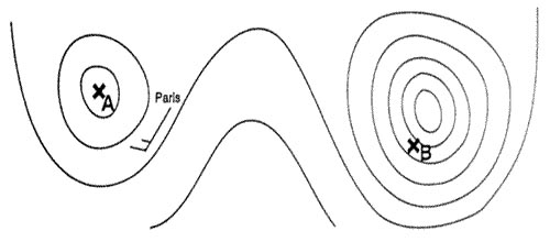
Question 171-19 : For the same horizontal distance between adjacent isobars the gradient wind speed will be least at ?
50°n with a cyclonic circulation.
First of all you have to uinderstand that the effect of the coriolis force varies with latitudes 566with the curvatures of the isobars centrifugal force is introduced and always tries to throw the parcel of air outwards from the centre of its rotation and the resulting movement of air is called the gradient wind green arrow = pgf pressure gradient force red arrow = coriolis force 583with an area of high pressure anticyclone the centrifugal force is acting in the same direction as pgf effectively increasing it coriolis balances the total force pgf + centrifugal force and the gradient wind is 'high round a high' ie for a given gap between the isobars the gradient wind is stronger than the geostrophic wind with an area of low pressure cyclonic circulation the centrifugal force is opposing the pgf effectively decreasing it coriolis balances the total force pgf centrifugal force and the gradient wind is 'low round a low' ie for a given gap between the isobars the gradient wind is weaker than the geostrophic wind for a given space between the isobars given pressure gradient you will get the least wind speed around a low cyclonic circulation at high latitude50°n in an anticyclone. 30°n with a cyclonic circulation. 30°n in an anticyclone.
Question 171-20 : Over which areas can tropical cyclones occur ?
Caribbean sea gulf of bengal indian ocean east of madagascar.
No tropical cyclones over lands neither over cold water such as north atlantic or oriental pacific cyclone from greek 'kuklos' means 'circle' is a generic term for all tropical revolving storms according to the geographical location the terminology differs cylcone in the south western and northern pacific ocean and the south western indian ocean hurricane as derived from huracàn a taino and carib god or hunraken the mayan storm in the northern atlantic ocean and the north eastern and south western pacific ocean east of 160e typhoon from chinese t'ai fung located in in the north western pacific ocean 603 caribbean sea gulf of bengal indian ocean east of madagascar is the only valid answerIndia, arabic sea, atlantic ocean at 2°s. australia, gulf of bengal, atlantic ocean at 20°s. caribbean sea, indian ocean at 20°s, pacific ocean at 2°n.
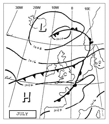
Question 171-21 : The hurricane season in the caribbean is mainly from ?
July until november.
510map showing areas affected by hurricanes in the caribbean area in summer and autumn the atlantic hurricane season runs from june 1st to november 30th the atlantic basin includes the atlantic ocean caribbean sea and gulf of mexico October until january. january until april. april until july.
Question 171-22 : Which statement about hurricanes in the north atlantic is correct ?
Their eye can be well observed by weather satellites.
They intensify after landfall they move towards the equator they move with a speed of at least 60 kt
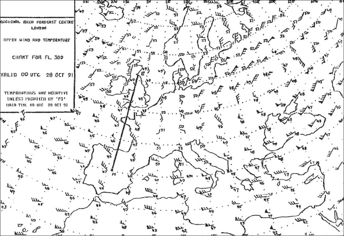
Question 171-23 : You are flying at fl 340 250 hpa on the northern hemispherethe wind is geostrophic and there is a cross wind from the right all the timeyour true altitude will ?
Increase.
We have a geostrophic wind when the pressure gradient force pgf is exactly balanced by coriolis force 582it is only happens when isobars are straights and parallelswith a cross wind from the right there must be low pressure behind and high pressure ahead you true altitude will increase air mass is warmer Decrease. decrease, only if the pressure at the surface is decreasing on your route. increase, only if the temperature at your flight level is rising on your route.
Question 171-24 : You are flying in the northern hemisphere at 2000 ft over a flat country area an anticyclone is ahead of you and a depression is behind you the wind affecting you will be ?
From your right.
If you stand with your back to the wind in the northern hemisphere low pressure is on your left high pressure is on your right buys ballot's law 608if you face the high pressure the wind affecting you will be from your rightFrom your left. from ahead. from behind.
Question 171-25 : Why do tropical revolving storms tend to develop mostly in the western parts of the tropical oceans ?
Because there is a maximum of humidity as a result of the trade winds long sea passage.
Because they are areas in which there is a strong progressive wind shear with increase of height because there is a maximal temperature difference between land mass and sea because the gulf formation of the coastlines triggers a strong rotary circulation
Question 171-26 : Over the indian ocean and the bay of bengal tropical cyclones are ?
Occasionally observed in the average 12 per year.
Rare, in the average one every two years. never observed. frequently observed, in the average 15 per year over the indian ocean, but never over the bay of bengal.
Question 171-27 : Tropical revolving storms are not formed in ?
South atlantic ocean.
Gulf of bengal. waters around the philippines. south indian ocean.
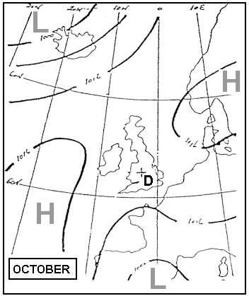
Question 171-28 : Between which latitudes are you most likely to find the region of travelling low pressure systems during summer ?
45° 70°.
58425° - 45°. 15° - 25°. 10° - 15°.
Question 171-29 : A stationary observer in the northern hemisphere is situated in front of a depression the centre of the depression passes from west to east and south of the observerfor this observer the wind ?
Backs.
627if the centre of the depression passes to the south of your position in the northern hemisphere the wind will change from south to nord passing by east a backing wind is a wind that turns counter clockwise Veers. initially veers, then backs. initially backs, then veers.
Question 171-30 : The region of the globe where the greatest number of tropical revolving storms occur is ?
The north west pacific affecting japan taiwan korea and the chinese coastline.
588the season for typhoons tropical revolving storms in north western pacific ocean extends from summer to autumnThe caribbean sea, affecting the west indies, mexico and the south-east coastline of the usa. the south-western indian ocean, affecting madagascar, mauritius and the island of reunion. the northern indian ocean, affecting india, sri lanka and bangladesh.
Question 171-31 : Which of the following statements is correct ?
At the equator horizontal motions do not induce any horizontal coriolis force.
The coriolis force is inversely proportional to the sine of latitude the coriolis force is directed in the same sense at all latitudes in gradient wind the coriolis force is in balance with the horizontal pressure gradient force and the frictional force
Question 171-32 : In the middle of the eye of a hurricane the wind speed is ?
Lower than 63 knots and the air is descending.
The center or eye of a hurricane is relatively calm the most violent activity takes place in the area immediately around the eye called the eyewallat the top of the eyewall about 50000 feet most of the air is propelled outward increasing the air's upward motion some of the air however moves inward and sinks into the eye creating a cloud free areaa hurricane is an intense tropical weather system with a well defined circulation and maximum sustained winds of 64 knots or higher thus in the middle of the eye the wind speed is lower than 63 knots and the air is descendingLower than 63 knots and the air is ascending. higher than 63 knots and the air is ascending. higher than 63 knots and the air is descending.
Question 171-33 : The geographical area where the frequency of the tropical revolving storms is highest is ?
South of chinese sea and philippines.
588the season for typhoons tropical revolving storms in north western pacific ocean extends from summer to autumnSouth atlantic ocean. indonesia. arabian sea (maritime zone west of india).
Question 171-34 : Which of the following is correct regarding a warm anticyclone ?
It increases in intensity with increasing altitude.
There are two main types of anticyclone a cold and warm anticyclone cold anticyclones form typically over polar climates here temperatures are very low and the air is often cold and dense an inversion tends to develop at low altitudes with anticyclones this prevents clouds from building any further if this is so any cumulus which does form during the daytime will quickly stop growing and spread into a layer of stratocumulus and then disperse when night comes at night when the temperatures drop below freezing frosts are very likely to formwarm anticyclones form mainly over tropical or sub tropical climates where temperatures are often warm both at day and night with these highs air is subsiding at quite a depth through the troposphere this tends to hold back and restrict any cloud formation if any cloud do form they will often be erratic and well broken these being mainly cumulus and stratocumulusApart from a surface inversion, the temperature increases with increasing altitude. it remains the same strength up to the tropopause. it weakens with altitude.
Question 171-35 : The arrows labelled 'v' represent the mean tracks of tropical revolving storms which occur mainly from 386 ?
December to april and are called cyclones.
Cyclone from greek 'kuklos' means 'circle' is a generic term for all tropical revolving storms according to the geographical location the terminology differs cylcone in the south western and northern pacific ocean and the south western indian ocean hurricane as derived from huracàn a taino and carib god or hunraken the mayan storm in the northern atlantic ocean and the north eastern and south western pacific ocean east of 160e typhoon from chinese t'ai fung located in in the north western pacific ocean 603December to april and are called hurricanes. may to november and are called typhoons. may to november and are called willy willys.
Question 171-36 : In the north atlantic you can often see a series of depressions located in a row and travelling from west to east these depressions ?
Are normally generated at the polar front.
Easa 2014polar front depressions which develop due to the polar front and cause bad weather conditions from the surface to the tropopause move from the atlantic towards europe their tracks are variable regions located south of each depression experience frontal weatherAre residuals of tropical cyclones in the florida area. are primarily generated by the vaporization process that takes place above the ocean. are mostly generated by convergence between the subtropical highs and the equatorial trough.
Question 171-37 : What are the typical weather conditions in an area with a flat pressure pattern in summer ?
Generally fine weather possibly thunderstorms in the afternoon or evening.
Easa 2014during summer in the centre of a stationary high pressure zone = flat pressure pattern we have light or no wind 492thunderstorms may occur in the summer months in the afternoon or evening due to convective activity the land warms causing convective lifting = cb Fine weather with strong westerly winds. steady rainfall. only short term weather improvements.
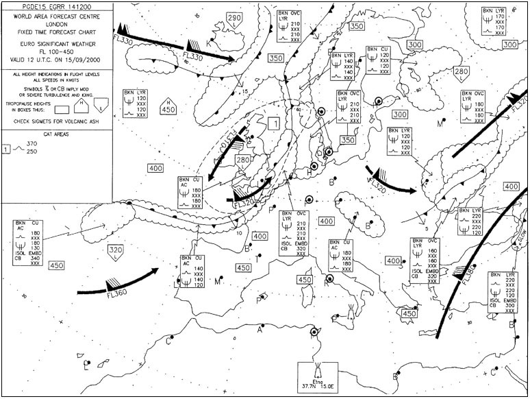
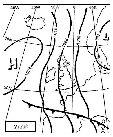
Question 171-38 : What change in pressure will occur at point b during the next hour 392 ?
Approximately constant pressure.
Easa 2014without a scale we can't tell if the cold front will pass through this position during the next hour but the question statement is during the next hour not 'in one hour'spacing of isobars at point b and in front of the cold front are the same therefore the pressure will not change during the next hour in about one and a half hours we can expect to see a drop in temperature and pressureA rise in pressure. a drop in pressure. irregular fluctuations.
Question 171-39 : A stationary observer in the northern hemisphere is situated in front of a depression the centre of the depression passes from west to east and north of the observer for this observer the wind direction is ?
Veering.
Ecqb03 july 2016warning looks like q978 but the center of the depression passes north of the observer in q978 it passes south 567a weering wind is a wind that turns clockwisea backing wind is a wind that turns counter clockwiseInitially veers, then backs. initially backs, then veers. backing.
Question 171-40 : The eye of a hurricane ?
Extends from the surface to the top of the hurricane.
Is filled with air which is colder than the air in the surrounding regions. has a diameter of a least 100 nm. cannot be spotted by satellites.
Exclusive rights reserved. Reproduction prohibited under penalty of prosecution.