A free Premium account on the FCL.055 website! Read here
Sign up to unlock all our services and 15164 corrected and explained questions.
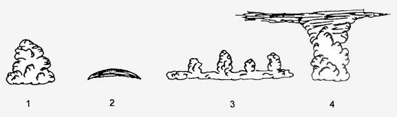
Question 176-1 : Fair weather cumulus often is an indication of ? [ Practice protocol ]
Turbulence at and below the cloud level
Question 176-2 : Visibility is reduced by haze when ?
Dust particles are trapped below an inversion.
A light drizzle falls a cold front just passed small water droplets are present
Question 176-3 : The most dangerous low level wind shears are encountered ?
When strong ground inversions are present and near thunderstorms.
In areas with layered clouds and wind speeds higher than 35 kt during any period when wind speed is greater than 35 kt and near valleys near valleys and at the windward side of mountains.
Question 176-4 : Vertical wind shear is ?
A change of horizontal wind direction andor speed with height.
643different winds at different levels = vertical wind shearA change of vertical wind speed with horizontal distance. a change of horizontal wind direction and/or speed with horizontal distance. a horizontal shear of vertical wind.
Question 176-5 : The most hazardous type of cloud that may be encountered on a cross country flight is ?
Cumulonimbus.
Stratocumulus. cumulus. cirrus.
Question 176-6 : During the life cycle of a thunderstorm which stage is characterized predominantly by downdrafts ?
Question 176-7 : What feature is normally associated with the initial stage of a thunderstorm ?
Continuous updraft.
Roll cloud. frequent lightning. rain or hail at the surface.
Question 176-8 : Large hail stones ?
Are typically associated with severe thunderstorms.
Only occur in thunderstorms of mid-latitudes are entirely composed of clear ice only occur in frontal thunderstorms
Question 176-9 : Which of the statements is true concerning squall lines ?
For severe squall lines a sigmet is issued.
Severe squall lines only occur in the tropics for severe squall lines a taf is issued severe squall lines always move from northwest to southeast
Question 176-10 : A gust front is ?
Formed by the cold air outflow from a thunderstorm.
Normally encountered directly below a thunderstorm characterized by heavy lightning another name for a cold front
Question 176-11 : What are the requirements for the formation of a thunderstorm ?
An adequate supply of moisture conditional instability and a lifting action.
A cumulus cloud with sufficient moisture associated with an inversion water vapour and high pressure a stratocumulus cloud with sufficient moisture
Question 176-12 : In which of the following areas is the highest frequency of thunderstorms encountered ?
Tropical.
Polar. subtropical. temperate.
Question 176-13 : A microburst with its damaging winds at the surface ?
Has a diameter up to 4 km.
Sometimes associated with thunderstorms microburst and macroburst will produce intense downdrafts that create damaging winds on the groundthese downdrafts are referred to as macrobursts or microbursts depending on their sizea macroburst is more than 5 km in diameter and can produce winds as high as 120 kt a microburst is smaller in dimension but produces winds as high as 150 kt on the groundHas a life time of more than 30 minutes. is always associated with thunderstorms. occurs only in tropical areas.
Question 176-14 : Thunderstorms can occur on a warm front if the ?
Warm air is moist and the environmental lapse rate exceeds the saturated adiabatic lapse rate.
Cold air is moist and the environmental lapse rate is less than the dry adiabatic lapse rate warm air is moist and the environmental lapse rate is less than the saturated adiabatic lapse rate cold air is moist and the environmental lapse rate exceeds the saturated adiabatic lapse rate
Question 176-15 : With which type of cloud are tornadoes associated ?
Cumulonimbus.
Stratus. cumulus mediocris. nimbostratus.
Question 176-16 : The diameter of a typical tornado is ?
100 to 150 metres.
Tornadoes forward motion is about 20 to 40 knots tornado paths range from 100 m to 15 km wide and are rarely more than 12 nm longthe path is not exactly the diameter of a tornado it includes a larger area around the tornado itself 493Only a few metres. about 2 to 6 km. in the order of 10 km.
Question 176-17 : In which stage of the life cycle of a single thunderstorm cell occur both up and downdrafts simultaneously ?
Mature stage.
Initial stage updraftsmature stage updrafts and downdraftsdissipating stage downdraftsCumulus stage. dissipating stage. in all stages.
Question 176-18 : During the formation of rime ice in flight water droplets freeze ?
Rapidly and do not spread out.
Slowly and do not spread out. slowly and spread out. rapidly and spread out.
Question 176-19 : Supercooled droplets can be encountered ?
At any time of the year.
Only in winter above 10000 ft. only in winter at high altitude. in winter only in high clouds.
Question 176-20 : Clear ice is formed when supercooled droplets are ?
Large and at a temperature just below freezing.
Small and at a temperature just below freezing small and freeze rapidly of any size at temperatures below -35°c.
Question 176-21 : Freezing precipitation occurs ?
Mainly in the form of freezing rain or freezing drizzle.
Only in the precipitation of a cold front. only in the precipitation of a warm front. mainly in the form of freezing hail or freezing snow.
Question 176-22 : In the vicinity of industrial areas smoke is most likely to affect surface visibility when ?
There is a low level inversion.
The surface wind is strong and gusty. cumulus clouds have developed in the afternoon. a rapid moving cold front has just passed the area.
Question 176-23 : Freezing fog consists of ?
Supercooled water droplets.
Frozen water droplets. frozen minute snow flakes. ice crystals.
Question 176-24 : Clear ice is dangerous because it ?
Is heavy and is difficult to remove from the aircraft surfaces.
Clear ice large supercooled water droplets spreading travel back during the freezing process and gradually increasing weight and difficult to removeIs translucent and only forms at the leading edges. is not translucent and forms at the leading edges. spreads out and contains many air particles.
Question 176-25 : Hoar frost forms on an aircraft as a result of ?
Water vapour turning directly into ice crystals on the aircraft surface.
When the surface temperature is lower than the dew point air in contact with the surface will be saturated since the dew point is below 0°c the water vapour will skip the liquid stage and form ice crystals on the cold surface which is called hoar frostexample of hoar frost 577on a cessna aircraft 578on an airbus a319Freezing rain striking the aircraft droplets forming on the aircraft and then freezing small super-cooled droplets striking the aircraft
Question 176-26 : On a clear summer day turbulence caused by solar heating is most pronounced ?
During the early afternoon.
Immediately after sunset during early morning hours before sunrise about midmorning
Question 176-27 : Clear ice forms as a result of ?
Supercooled water droplets spreading during the freezing process.
Water vapour freezing to the aircraft. ice pellets splattering on the aircraft. supercooled droplets freezing on impact.
Question 176-28 : The type of icing that occurs in dense clouds with large supercooled drops that have a temperature of 5°c is most likely to be ?
Clear ice.
Hoar frost. rime ice. cloudy ice.
Question 176-29 : Below a low level inversion visibility is often ?
Moderate or poor because there is no vertical exchange.
Very good at night. very good in the early morning. moderate or poor due to heavy snow showers.
Question 176-30 : Given the following metar eddm 250850z 33005kt 2000 r26rp1500n r26l1500n br sct002 ovc003 0505 q1025 nosigwhich of the following statements is correct ?
Visibility is reduced by water droplets.
Icao annex 3 meteorological service 4366 recommendation in metar and speci when instrumented systems are used for the assessment of runway visual range the variations in runway visual range during the 10 minute period immediately preceding the observation should be included as follows if the runway visual range values during the 10 minute period have shown a distinct tendency such that the mean during the first 5 minutes varies by 100 m or more from the mean during the second 5 minutes of the period this should be indicated when the variation of the runway visual range values shows an upward or downward tendency this should be indicated by the abbreviation 'u' or 'd' respectively in circumstances when actual fluctuations during the 10 minute period show no distinct tendency this should be indicated using the abbreviation 'n' when indications of tendency are not available no abbreviations should be includedr26rp1500 n r26l1500 n 'n' = rvr has not changed in the last 10 minutes before the reportr26r p 1500n rvr on 26r is more than 1500 mr26l1500n rvr on 26l is 1500 mbr = mist mist is made up of water droplets Runway 26r and runway 26l have the same rvr. rvr on runway 26r is increasing. there is a distinct change in rvr observed.
Question 176-31 : Flight visibility from the cockpit during approach in a tropical downpour can decrease to minimal ?
Tens of metres.
About 1000 metres. about 200 metres. about 500 metres.
Question 176-32 : Which of the following factors have the greatest effect on the formation of the various types of ice on an aircraft ?
Cloud temperature and droplet size.
Aircraft speed and size of cloud droplets aircraft speed and curvature of the airfoil relative humidity inside the cloud
Question 176-33 : Hoar frost is most likely to form when ?
Taking off from an airfield with a significant ground inversion sky clear .
Hoar frost will form in clear air when an aircraft has been parked overnight in sub zero temperatures and will form when an aircraft flies from sub zero temperature air into warm moist air such as in descent or climbing through a temperature inversion layerexample of hoar frost 577on a cessna aircraft 578on an airbus a319Flying inside convective clouds. flying inside stratiform clouds. flying in supercooled drizzle.
Question 176-34 : Two aircraft one with a sharp wing profile s and the other with a thick profile t are flying through the same cloud with same true airspeed the cloud consists of small supercooled dropletswhich of the following statements is most correct concerning ice accretion ?
Aircraft s experiences more icing than t.
Ice tends to accrete on airfoils in different ways depending on the airfoil the aoa and other aircraft variables a sharp wing profile is a high performance profil with a shallow boundary layerthe boundary layer that surrounds a thick profile is deeper than a sharp wing profile and most of the super cooled droplets that penetrate this layer are centrifuged off again and only a small proportion form ice on the leading edgeAircraft t experiences more icing than s. aircraft s and t experience the same amount of icing. neither of the aircraft accumulate ice due to the small size of droplets.
Question 176-35 : While descending through a cloud cover at high level a small amount of a white and rough powderlike contamination is detected along the leading edge of the wing this contamination is called ?
Rime ice.
Rime ice forms through the freezing onto aircraft surfaces of small supercooled water dropsduring the formation of rime ice in flight water droplets freeze rapidly and do not spread outthe question gives a good description of the formation of rime ice clear ice mixed ice and hoar frost would not be confined to the leading edgesClear ice. mixed ice. frost.
Question 176-36 : A small supercooled cloud droplet that collides with an airfoil will most likely ?
Freeze immediately and create rime ice.
Rime ice small supercooled water droplets accumulating forward of the direction of the airstream they freeze immediately granular textureclear ice large supercooled water droplets spreading travel back during the freezing process and gradually increasing weight and difficult to removeTravel back over the wing, creating clear ice. travel back over the wing, creating rime ice. freeze immediately and create clear ice.
Question 176-37 : A flight is to depart from an airport with runways 09 and 27 surface wind is 27005an inversion is reported at 300 feet with turbulence and wind shear the wind just above the inversion is 09030what is the safest departure procedure ?
Depart on runway 09 with a tailwind.
When the tailwind component is no greater than 10 kt for most of commercial aircraft depart with tailwind is allowedjust after the thin inversion layer you will take benefit of the headwind to quickly leave the turbulence area behind and below youTake-off is not possible under these conditions. depart runway 27 with as steep an ascent as possible. depart runway 27 with maximum throttle during the passage through the inversion.
Question 176-38 : The turbulence which occurs at high flight levels above fl 250 is mainly of the type clear air turbulence in what way can moderate to severe clear air turbulence affect an aircraft the flight and the passengers ?
The turbulence is a small scale one and can cause damage the manoeuvring of the aircraft will be made more difficult or even impossible for the passengers the flight will be unpleasant.
Turbulence can occur in clear air particularly near the tropopause clear air turbulence cat is associated with jet streams standing waves air surrounding cumulo nimbus cb cloud upper level troughs and sometimes upper level ridges it is caused by horizontal or vertical windshear and can lead to stalling loss of control and airframe damageThe turbulence is a large scale one (waving) so that the aircraft will be difficult to manoeuvre. the passengers will feel some discomfort. the turbulence can be resembled with the roughness of a washing-board (small scale) and will not have influence on the aircraft and its solidity, but will make flight a little more difficult. the passengers will seldom notice anything of this turbulence. the turbulence is wave like which makes the flight unpleasant for the passengers but the manoeuvring will not be affected essentially.
Question 176-39 : Aircraft struck by lightning may sometimes get considerable damage and at least temporarily the manoeuvring of the aircraft will be made more difficult which one of the following statements is correct ?
Aircraft made by composite material may get severe damage the crew may be blinded and temporarily lose the hearing.
Lightning regularly strikes airplanes any aircraft whatever the construction may be struck by lightning and can get considerable damageprotection begins with the fact that airliners and the majority of other airplanes are made of aluminium which is a very good electrical conductor a lightning bolt's electricity flows along the airplane's skin and into the air 581the boeing 787 aircraft is an aircraft made by composite material it is far more vulnerable to lightning strikes the energy deposited in a typical lightning strike involves tens of kv and 10000 200000 amperes occurring in a fraction of a second without some type of shielding or conductive path conductive material added to the composites the electrically insulated carbon fiber epoxy composites can be damaged particularly at the entry and exit points for the strike the aircraft instrumentation can also be damaged in such an event and extra shielding is often necessary for composite aircraftdue to the high intensity of the flash light the crew may be blinded and temporarily lose the hearing due to the impact noiseAn aircraft made by metal has a certain capacity to attract a lightning, but the lightning will follow the surface and therefore no damage will be caused. an aircraft has in the atmosphere the same qualities as a 'faradays cage', which means that struck of lightning seldom occurs. but if it happens, the result will be an occasional engine failure. the crew may get a shock. aircraft made by composite material can't conduct a lightning and will therefore very seldom be struck.
Question 176-40 : The most dangerous icing conditions are encountered in ?
Supercooled precipitation.
Unstable clouds at medium levels. zones where the air temperature is below -15°c. icy clouds at high levels.
Exclusive rights reserved. Reproduction prohibited under penalty of prosecution.