A free Premium account on the FCL.055 website! Read here
Sign up to unlock all our services and 15164 corrected and explained questions.
Question 178-1 : What intensity and type of aircraft icing is likely to occur at fl 100 in a thunderstorm with the freezing level at 7000 ft ? [ Practice protocol ]
Moderate to severe icing due to clear ice
Question 178-2 : The presence of ice pellets at the surface is the evidence that ?
Temperatures are above freezing at some higher altitudes.
A cold front has passed. there are thunderstorms in the area. after take-offyou can climb to a higher altitude without encountering more than light icing conditions.
Question 178-3 : At the surface the lifetime of a typical microburst and the diameter of the area affected by damaging winds are in the order of ?
1 5 minutes and 4 km.
A microburstdownburst is a localized area of damaging winds caused by air rapidly flowing down and out of a thunderstorm a microburst occurs when cold air high in a thunderstorm descends and accelerates as the stream of cold air reaches the ground it spreads out and can accelerate even further30-40 minutes and 4 km. 5-15 minutes and 8 km. 5-10 minutes and 12 km.
Question 178-4 : In mature cb's the probability of severe icing according to meteorological rules is greatest in the following temperature range ?
0°c to 23°c.
+5°c to 0°c. -23°c to -40°c. -40°c to -60°c.
Question 178-5 : In which environment is aircraft structural ice most likely to have the highest accumulation rate ?
Freezing rain.
Stratus clouds. cirrus clouds. snow.
Question 178-6 : An aircraft descends in layered clouds the freezing level is situated at fl 60at what levels is the probability for airframe icing the highest ?
Between fl 120 and fl 60.
The probability for airframe icing is the highest for temperatures just below 0°c if the freezing level is at fl60 from fl60 to fl120 the temperature decreases from 0°c to 12°cBetween fl 60 and fl 20. between fl 120 and fl 180. at fl 140.
Question 178-7 : According to icao which symbol indicates danger to an aircraft flying according to instrument flight rules ifr 363 ?
Symbol 2.
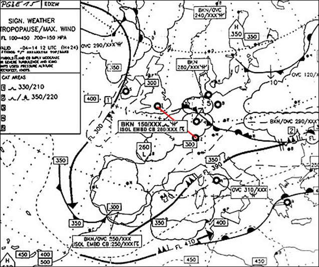
629drizzle widespread mist and rain are not considered as dangerSymbol 4. symbol 1. symbol 3.
Question 178-8 : In which of the following situations is the probability for severe thunderstorms the highest ?
Advection of maritime cold air over a warm sea surface.
Maritime cold air means 'moist air' over a warm surface this cold air will be heated by convection lower layer will rise and increase instability this will lead to the formation of cumulonimbus with possible severe thunderstormsAdvection of warm air over a cold land surface. advection of continental cold air over a warm land surface. advection of maritime warm air over a cold sea surface.
Question 178-9 : In which of these cloud types can icing be virtually ruled out ?
Cs.
As sc ns
Question 178-10 : According to icao which symbol indicates danger to an aircraft flying according to instrument flight rules ifr 371 ?
Symbol 3.
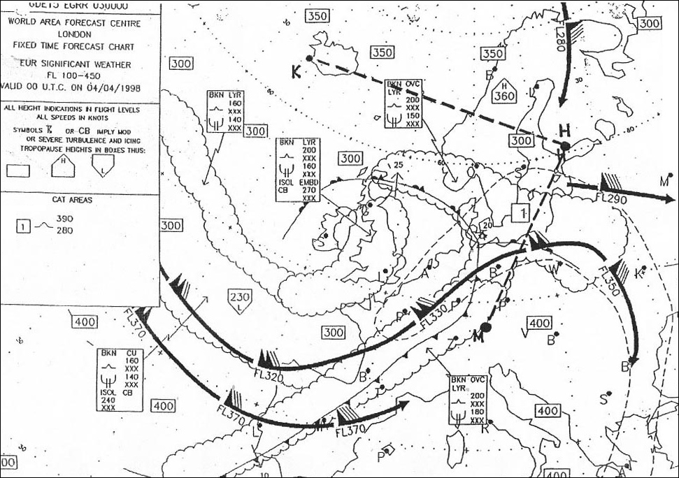
629Symbol 4. symbol 1. symbol 2.
Question 178-11 : In which conditions would you most likely encounter clear icing and how would it normally appear ?
Cumuliform clouds large water droplets temperatures between 0°c and 15°c appears smooth and tends to spread back over an aircraft wing.
Stratiform clouds, small water droplets, temperatures between -10°c and -20°c. appears granular and tends to accumulate forward into the air stream. cumuliform clouds, small water droplets, temperatures between -20°c and 25°c. appears transparent and tends to take the shape of the surface on which it freezes. stratiform clouds, large water droplets, temperatures well below freezing. appears opaque and builds forward from leading surface into a sharp edge.
Question 178-12 : A cb with thunderstorm has reached the mature stage which statement is correct ?
In temperatures lower than 23°c icing is still possible.
Initial stage updraftsmature stage updrafts and downdraftsdissipating stage downdraftshail can occur in downdrafts and updraftsyou will have severe turbulence in the cloud and belowthe freezing level remains almost the same in an outside the cloudwith temperatures lower than 23°c icing is still possible since some lifted water droplets are at positive temperaturesThe freezing level in the whole cloud lies lower than outside the cloud. if hail occurs, it only occurs in downdrafts. severe turbulence occurs in the cloud, but hardly ever below the cloud.
Question 178-13 : Which of the following statements is true with regard to mountain waves ?
Flight with headwind toward high ground is likely to be more hazardous than flight with tailwind toward high ground.
634headwind implies that you are flying towards the ridge and while approaching the ridge you are most likely to encounter violent downdraught and rotors Mountain waves are not experienced beyond 100 miles downwind from initiating high ground, regardless of the height of the ground. the absence of cloud over high ground indicates the absence of mountain waves. flight with tailwind toward high ground is likely to be more hazardous than flight with headwind toward high ground.
Question 178-14 : The correct statement is ?
Airframe icing can occur in clear air.
Light airframe icing can occur in clean airhaze is a reduction of visibility due to the presence of dust particlesrotor clouds depend on mountain waves intensity and moisture of the air masssome cb can extend above the tropopause thus you can encounter turbulence above themHaze is a reduction of visibility due to the presence of water vapour. mountain waves are always accompanied by rotor clouds. above the tropopause no turbulence occurs.
Question 178-15 : Flight from bordeaux to amsterdam eta 2100 utc what is the minimum visibility forecast for eta amsterdam taf eham 281500z 281601 14010kt 6000 ra sct025 becmg 1618 12015g25kt sct008 bkn013 tempo 1823 3000 ra bkn005 ovc010 becmg 2301 25020kt 8000 nsw bkn020 = ?
3 km.
5 km. 5 nm. 6 km.
Question 178-16 : What are the conditions required for the formation of hoar frost ?
The temperature of the surface is lower than the dew point of the air and the dew point is lower than 0°c.
When the surface temperature is lower than the dew point air in contact with the surface will be saturated since the dew point is below 0°c the water vapour will skip the liquid stage and form ice crystals on the cold surface which is called hoar frostFalling droplets on a surface while the air temperature is below freezing. the temperature of the surface is higher than the dew point of the air and the dew point is lower than 0°c. falling droplets on a surface with a temperature below freezing.
Question 178-17 : Imagine an airfield during summer with sunny days and clear nights and with a runway parallel to the shoreline of a large inland lake 5 nautical miles away from the fielda small aircraft heading for the airfield in the afternoon experiences wind shear during approach and a cross wind component which ?
A strong sea breeze blowing more or less perpendicular to the runway.
A radiation inversion due to surface cooling during the clear night. a subsidence inversion typical for summer anticyclones causing variations in wind speed and direction near the surface. a strong land breeze blowing more or less perpendicular to the runway.
Question 178-18 : Which of the following situations favours the formation of heavy thunderstorms ?
A cold front approaching a mountain range in the evening.
Cqb15 august 2011The passage of a warm front in the morning. a cold front on the leeward side of a mountain range. a warm sector moving over a snow-covered ground.
Question 178-19 : The wind at 500ft above ground is 29015kt and at the same position at 600ft above ground 30022kthow is this wind situation called ?
Moderate vertical wind shear.
Cqb15 august 2011Severe horizontal wind shear. gradual horizontal wind shear. severe low level turbulence.
Question 178-20 : Imagine an aircraft during approach to an airfield which is located in a basin within mountainous area under the influence of a blocking anticyclone in winter the most correct statement given below is ?
While approaching the airfield in the early morning after a short period of bumpiness the engines of the aircraft will deliver more thrust after breaking through the inversion layer if the pilot does not intervene.
Cqb15 august 2011While approaching the airfield shortly before sunrise, the pilot has to consider turbulence because at first lift will be decreased due to katabatic winds and, after breaking through a valley inversion layer, lift is likely to improve due to anabatic wind. while approaching the airfield in the late evening hours, without the pilot's intervention the engines of the aircraft are most likely to provide less thrust after breaking through the inversion layer. while approaching the airfield in the early morning hours, these conditions apply for the possibility of a marked valley inversion which has to be considered as a potential flight hazard due to a decreased lift after breaking through the inversion layer.
Question 178-21 : Mark the statement most reasonable regarding a valley inversion ?
Over night cool dense air as a result of radiation cooling will descend along the mountain slopes into the basin and lead to the development of a valley inversion.
Cqb15 september 2011If the incident solar radiation is non-uniform because of orographic conditions, the development of a valley inversion is very likely during daytime. provided that the lee side winds are able to displace the air at the bottom of the basin, the foehn effect is the predominant factor in the development of a valley inversion. small scale density variations due to turbulent mixing (mainly caused by the roughness of rocks) are a significant prerequisite for the formation of valley inversions.
Question 178-22 : Which of the following statements is correct concerning the weather in a warm sector ?
Isolated thunderstorms are sometimes possible over continental areas during the summer.
Cqb 15 october 2011No thunderstorms can occur. in mid and high latitudes thunderstorms may occur only over open sea during the summer. isolated air mass thunderstorms are common during all seasons over continental areas.
Question 178-23 : With which meteorological phenomena are wind shear conditions mostly associated ?
Gust fronts low level temperature inversions frontal surfaces.
Cqb 15 october 2011Gust fronts, sea breeze fronts, high stratiform clouds. strong surface winds coupled with local topography, anticyclones, light precipitation. thunderstorms, drizzle, conditional instability.
Question 178-24 : In winter after breaking through a low level inversion during descent and assuming the pilot does not intervene ?
Thrust most likely will increase and visibility is likely to deteriorate.
Usually when you descend your oat outside air temperature is increasing but when you descend into an inversion layer your oat will start to decrease instead of increasing you would expect an increase in thrustLift most likely will increase and visibility is likely to improve. thrust most likely will decrease and visibility is likely to improve. lift most likely will decrease and visibility is likely to deteriorate.
Question 178-25 : The presence of ice pellets at the surface is the evidence that ?
Temperatures are above freezing at some higher altitudes.
A cold front has passed. there are thunderstorms in the area. after take-off you can climb to a higher altitude without encountering more than light icing conditions.
Question 178-26 : Mark the correct statement concerning lightning discharge ?
While flying through air that is electrically charged the aircraft is likely to become a charge carrier itself and can initiate a lightning discharge.
The probability of a lightning discharge is reciprocally proportional to the strength of the electric field the aircraft intruded. the set of possible effects of a lightning discharge does not include welding of aircraft parts such as joints or bearings. because an aircraft acts as a 'faraday's cage', the magnetisation associated with a lightning discharge hardly has an effect on the magnetic compass.
Question 178-27 : Most tornadoes have a life span that lasts for ?
A few minutes up to 30 minutes.
Approximately one hour. several hours. not more than one minute.
Question 178-28 : During an ils approach on rwy 33 a northwesterly wind is blowing parallel to the runway its speed is increasing rapidly with height while its change in direction is negligiblewhat has the pilot to be aware of with respect to wind shear and glide path no autopilot engaged ?
Without the pilot's intervention the aircraft is likely to fly below the designated glide path with increasing deviation from it.
The wind is blowing parallel to the runway it's a headwindyou are descending into an increasing headwind wind shear and with constant aispeed and angle of attack this will give a decreasing ground speed you normally have to decrease the rate of descent in order to maintain the glide slope but without intervention you will maintain a rate of descent for a higher ground speed this will result to fly below the designated glide path with increasing deviation from it since the question states is increasing rapidly with height take care not to understand an increase of wind with an increase of altitude we are talking about wind shear not a standard atmosphere windWithout the pilot's intervention, the aircraft is likely to fly above the designated glide path with increasing deviation from it. a deviation from the glide path will not have to be considered since there is no significant wind shear to be expected. without the pilot's intervention, the aircraft is likely to fly above the designated glide path with decreasing deviation from it.
Question 178-29 : Mark the correct statement concerning the flight through an inversion caused by subsidence ?
During climb the reduced air density above the inversion layer will cause a certain decrease in the aircraft performance ie lift and thrust and the pilot will experience a sudden improvement of visibility.
Rencag temperature falls above the inversion layer so density should increase isn't it the question states flight through an inversion not above the inversion layerbelow the inversion layer air temperature decreases with height inside the inversion air temperature increases with heightDuring climb, the increased air density above the inversion layer will cause a certain increase in the aircraft performance (ie: lift and thrust) and the pilot will experience a gradual change of the cross wind component. during climb, the pilot of an aircraft probably will experience a slight deterioration of flight visibility when breaking through the top of the inversion layer and the general aircraft performance will decrease. the pilot of an aircraft probably will experience a gradual increase of the cross wind component and a gradual improvement of flight visibility when breaking through the base of the inversion layer during descent.
Question 178-30 : Clouds will mainly consist of supercooled water droplets when the temperature is ?
Between 0°c and 15°c.
Between -5°c and -30°c. between -30°c and -40°c. below -40°c.
Question 178-31 : A stormscope is ?
An instrument on board an aircraft to detect electrical discharges.
A stormscope is basically a lightning detectorAn instrument to detect wind shear by means of the doppler-effect during flight. the technical term (jargon) for a radar scope showing thunderstorms. an instrument to measure wind velocity.
Question 178-32 : Most tornadoes have a speed of movement that usually ranges from ?
20 to 40 knots.
Take care the question is about the tornadoes forward motion not the wind speed inside the tornadoestornado paths range from 100 m to 15 km wide and are rarely more than 12 nm longthey can last from several seconds to more than an hour however most don't exceed 10 minutesmost tornadoes travel with an average speed of 30 kt but the speed has been observed to range from almost no motion to 60 kt100 to 140 knots. 30 to 70 knots. 120 to 180 knots.
Question 178-33 : Which of the following statements regarding the development of valley inversions is correct ?
Valley inversions often are a result of radiation cooling in combination with gravity both affecting the air at the surface of a mountain slope.
Over night cool dense air as a result of radiation cooling will descend by gravity along the mountain slopes into the basin and lead to the development of a valley inversionUsually a valley inversion is initiated by radiation cooling and anabatic winds which are due to orographic conditions. the most important prerequisite for the development of valley inversions is warm air ascending along the mountain slope, thus leaving cooler air behind in the bottom of the valley. the predominant factor in the development process of valley inversions is the non-uniformity of incident solar radiation due to orographic conditions in combination with density variations within the air.
Question 178-34 : During the preparation for approach to zurich airport 1416 ftamsl a pilot hears the following message on the atis 'inversion warning inversion of 12°c between 1900 ft and 2300 ft altitude'this message indicates that the pilot should be prepared ?
For wind shear just above the inversion.
Low level temperature inversion can be a safety hazard it can be a significant factor in affecting take off or landing performance information regarding low level temperature inversions should be provided as soon as possible 646an inversion will promote vertical wind shearFor freezing precipitation below the inversion. for fog below the inversion. that the performance of the engine will be reduced from inversion level down to ground.
Question 178-35 : When flying in mountainous terrain and assuming isa temperatures and strong winds which of the following is correct ?
In case of venturi effect the actual altitude of the aircraft is lower than the indicated altitude.
With strong winds the mountainous terrain will acts like a wing you will have a reduced pressure over a hill it acts like a cambered aerofoil in case of venturi effect in this area of reduced pressure the altimeter will over read it sence a lower pressure it reads a higher altitude than it should 641venturi effect static pressure decreased compared to original In case of adiabatic compression of the air, the temperature is lower than indicated. in case of combined effect of surface friction and adiabatic compression of the air, the dynamic pressure is lower than indicated by the altimeter. in case of venturi effect, the indicated altitude of the aircraft is lower than the actual altitude.
Question 178-36 : What degree of aircraft icing is determined by the following icao description 'conditions in which change of heading andor altitude may be considered desirable' ?
Moderate.
Light. severe. violent.
Question 178-37 : Two aircraft are flying simultaneously in level flight at different flight levels on opposite tracks overhead a given positionaircraft a flying at fl 070 experiences a 30 kt headwindaircraft b flying at fl 060 experiences a 20 kt headwindnone of the aircraft experiences cross wind this wind ?
Vertical wind shear only.
643vertical shear is the change of winds with heightVertical and horizontal wind shear. horizontal wind shear only. no wind shear since the absolute value of the difference in wind velocity per height unit is too small to fit the definition of wind shear at all.
Question 178-38 : What is the best way in dealing with thunderstorms associated with a cold front ?
Avoidance of embedded cbs by using airborne weather radar.
Ecqb01 june 2013Flying through the front with maximum speed and perpendicular to the front line in order to minimize the time of hazard exposure. flying underneath the cloud base in all cases. flying through the upper third of the clouds to prevent the aircraft from being struck by lightning.
Question 178-39 : Orographic thunderstorms may occur ?
At any time during day and night.
Ecqb01 june 2013Almost exclusively during the daylight hours. mostly between sunset and 2 a.m. mostly in the early morning.
Question 178-40 : During flight the headwind increases suddenly due to wind shear what initial effect does that have on true airspeed ?
There will be a sudden temporary increase in true air speed.
Easa 2014None, since wind only affects ground speed and drift. there will be a sudden temporary decrease in true air speed. there will only be a gradual increase in true airspeed until equilibrium is established again.
Exclusive rights reserved. Reproduction prohibited under penalty of prosecution.