A free Premium account on the FCL.055 website! Read here
Sign up to unlock all our services and 15164 corrected and explained questions.
Question 194-1 : Correct statement about a polar stereographic chart is ? [ Level reports ]
The closer the pole the higher straight line chart approximates the great circle
Question 194-2 : Levels curve on a hypsometric chart refer to ?
Altitude.
A hypsometric chart is a map having contour lines through points of equal elevation com encom061 707jpgusually hypsometric map shows elevation by means of shading and tintingLongitude. latitude. magnetic variation.
Question 194-3 : On a lambert conformal projection the scale at a point at 60°n in the direction of truenorth is 1 1000000what is the scale at the same point in an easterly direction ?
1 1000000.
The scale in the direction cannot be calculated as the longitude of the position is not given. 1:500.000. 1:2.000.000.
Question 194-4 : It can be stated concerning a mercator chart ?
It is a designated as cylindrical projection but it is in fact mathematically produced.
Projection on a cylinder is the exact way of construction of mercator chart. it is a projection from the centre of the earth via straight lines on a cylinder tangential to the equator. the projection from the centre of the earth on a cylinder gives conformity.
Question 194-5 : A chart with a small scale is a chart that cover ?
Big areas and does not show many details.
Small scale = small detailthe scale of a chart refers to a measurement of area not distance a chart covering a relatively large area is called a small scale chart eg 1 1 000 000Small areas and shown a lot of details. small areas and does not show many details. big areas and show a lot of details.
Question 194-6 : A chart with a large scale is a chart that cover ?
Small areas and shown a lot of details.
Large scale = large detailthe scale of a chart refers to a measurement of area not distance a chart covering a relatively large area is called a large scale chart eg 1 10 000Big areas and does not show many details. small areas and does not show many details. big areas and show a lot of details.
Question 194-7 : For navigation a polar stereographic chart is usedthe straight line between a 75°00'0s 166°00'0e and b 78°00'0s 154°00'0e is drawn in this chart the true track angle of the rhumbline is 223°calculate the direction °t of the straight line in position b ?
229°.
322°. 310°. 180°.
Question 194-8 : For navigation a polar stereographic chart is usedthe straight line between a 75°00'0n 166°00'0e and b 78°00'0n 154°00'0e is drawn in this chartthe true track angle of the rhumbline in b is 317°calculate the direction °t of the straight line in position b ?
311°.
325°. 329°. 305°.
Question 194-9 : Two positions at the same latitude are plotted on an aeronautical chart and the meridians at these two positions converge by 30°given this convergence the true ?
Great circle route between these two positions will vary by 30°.
Rhumb line and great circle route between these two positions will differ by 30° at any point. course of the rhumb line between these two positions will vary by 30°. course of a straight line charted between these two positions will vary by 30°.
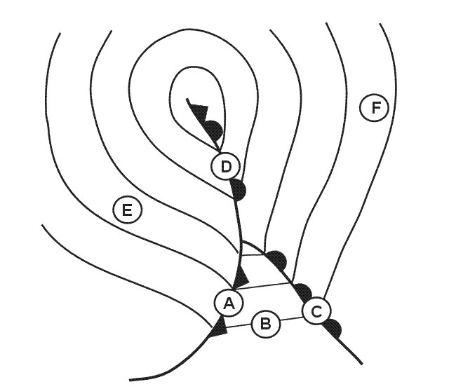
Question 194-10 : Why can parallels be considered as special loxodromies ?
They intersect all meridians at an angle of 90°.
They connect the north pole to the south pole. their center is the center of the earth. they intersect all meridians at an angle of 45°.
Question 194-11 : What is the radial and dme distance from bel vordme n54397 w006138 to position n5500 w00700 err a 061 243 ?
315° 34 nm.
Img com encom061 243jpguse the magnetic tick and center your protractor you read 315°use the scale to find a distance of 34 nm296° - 65 nm. 126° - 33 nm. 222° - 48 nm.
Question 194-12 : What is the average track °m and distance between crk vor n51504 w008297 and crn ndb n53181 w008565 err a 061 245 ?
357° 89 nm.
Img com encom061 245jpguse the magnetic north pointer at shannon center your protractor and read an average magnetic track of 357°use the scale to find the distance we find a distance of 90 nm but it might come from the chart qualityfor information 349° is the average true track169° - 91 nm. 349° - 90 nm. 177° - 92 nm.
Question 194-13 : What is the average track °m and distance between wtd ndb n52113 w007050 and bal vor n53180 w006269 err a 061 247 ?
026° 71 nm.
018° - 153 nm. 206° - 71 nm. 198° - 72 nm.
Question 194-14 : What is the average track °m and distance between bal vor n53180 w006269 and slg ndb n54167 w008360 err a 061 249 ?
316° 96 nm.
Img com encom061 249ajpguse the scale to find the distance 96 nm com encom061 249bjpgmagnetic north is indicated over vors and ndbs report the magnetic north tick center your protractor you read an average magnetic track of 316°262° - 86 nm 128° - 99 nm 308° - 98 nm
Question 194-15 : What is the radial and dme distance from crk vordme n51504 w008297 to position n5210 w00920 err a 061 403 ?
311° 38 nm.
350° - 22 nm 295° - 38 nm 170° - 22 nm
Question 194-16 : What is the radial and dme distance from crk vordme n51504 w008297 to position n5140 w00730 err a 061 405 ?
Question 194-21 : What is the average track °t and distance between con vor n53548 w008491 and bel vor n54397 w006138 err a 061 415 ?
063° 101 nm.
Report the true north tick center your protractor you read an average true track of 063° com encom061 415pnguse the scale to find the distance 101 nm071° - 100 nm. 113° - 97 nm. 293° - 98 nm.
Question 194-22 : What is the average track °t and distance between wtd ndb n52113 w007050 and foy ndb n52340 w009117 err a 061 417 ?
286° 81 nm.
Report the true north tick center your protractor you read an average true track of 286° com encom061 417jpguse the scale to find the distance 81 nm294° - 80 nm 075° - 81 nm 277° - 83 nm
Question 194-23 : What is the average track °t and distance between sha vor n52433 w008531 and con vor n53548 w008491 err a 061 419 ?
002° 72 nm.
Report the true north tick center your protractor you read an average true track of 002° com encom061 419jpguse the scale to find the distance 72 nm010° - 71 nm 358° - 72 nm 006° - 71 nm
Question 194-24 : What is the average track °t and distance between bal vor n53180 w006269 and cfn ndb n55026 w008204 err a 061 421 ?
327° 124 nm.
Report the true north tick center your protractor you read an average true track of 327° com encom061 421jpguse the scale to find the distance 124 nm335° - 128 nm. 330° - 130 nm. 320° - 127 nm.
Question 194-25 : Given sha vor n52433 w008531 radial 205° crk vor n51504 w008297 radial 317° what is the aircraft position err a 061 424 ?
N5210 w00910.
com encom061 424jpgN5118 w00913 n5205 w00915 n5215 w00917
Question 194-26 : Given sha vor n52433 w008531 radial 129° crk vor n51504 w008297 radial 047° what is the aircraft position err a 061 426 ?
N5220 w00750.
com encom061 426jpgN5215 w00755 n5210 w00750 n5205 w00755
Question 194-27 : Given sha vordme n52433 w008531 radial 120°35 nm what is the aircraft position err a 061 428 ?
N5230 w00800.
com encom061 428jpgN5225 w00805 n5220 w00750 n5240 w00750
Question 194-28 : Given sha vordme n52433 w008531 radial 232°32 nm what is the aircraft position err a 061 430 ?
N5220 w00930.
N5305 w00815 n5228 w00935 n5303 w00810
Question 194-29 : Given sha vordme n52433 w008531 radial 048°22 nm what is the aircraft position err a 061 432 ?
N5300 w00830.
com encom061 432jpgN5228 w00920 n5258 w00825 n5225 w00917
Question 194-30 : Given sha vor n52433 w008531 crk vor n51504 w008297aircraft position n5230 w00820which of the following lists two radials that are applicable to the aircraft position err a 061 434 ?
Sha 131° crk 017°.
Debiassi when two answers are quite close try to line up the douglas protractor with two known values ie sha 052° and 115° radials for the airways this really improves accuracySha 304°, crk 189°. sha 312°, crk 197°. sha 124°, crk 009°.
Question 194-31 : Given sha vor n52433 w008531 con vor n53548 w008491 aircraft position n5330 w00800 which of the following lists two radials that are applicable to the aircraft position err a 061 436 ?
Sha 042° con 138°.
com encom061 436jpgmagnetic north is indicated over vors and ndbsSha 213° con 310° sha 033° con 130° sha 221° con 318°
Question 194-32 : Given sha vor n52433 w008531 dme 50 nm crk vor n51504 w008297 dme 41 nm aircraft heading 270° m both dme distances increasingwhat is the aircraft position err a 061 438 ?
N5200 w00935.
com encom061 438jpgyou draw two circles use the vertical scale to define the distances both dme distances increasing so this is the only valid junction positionN5215 w00940 n5215 w00745 n5235 w00750
Question 194-33 : Given crn vor n53181 w008565 dme 18 nm sha vor n52433 w008531 dme 30 nm aircraft heading 270° m both dme distances decreasing what is the aircraft position err a 061 440 ?
N5310 w00830.
N5252 w00923 n5307 w00923 n5355 w00825
Question 194-34 : Given con vor n53548 w008491 dme 30 nm crn vor n53181 w008565 dme 25 nm aircraft heading 270° m both dme distances decreasing what is the aircraft position err a 061 442 ?
N5330 w00820.
N5343 w00925 n5335 w00925 n5337 w00820
Question 194-35 : Given sha vordme n52433 w008531 birr aerodrome n5304 w00754 what is the sha radial and dme distance when overhead birr aerodrome err a 061 444 ?
068° 41 nm.
248° - 42 nm 060° - 42 nm 240° - 41 nm
Question 194-36 : Given con vordme n53548 w008491 castlebar aerodrome n5351 w00917 what is the con radial and dme distance when overhead castlebar aerodrome err a 061 446 ?
265° 17 nm.
077° - 18 nm 257° - 17 nm 086° - 18 nm
Question 194-37 : An aircraft departs from position a 04°10' s 178°22'w and flies northward following the meridian for 2950 nmit then flies westward along the parallel of latitude for 382 nm to position bthe coordinates of position b are ?
Question 194-38 : What is the time required to travel along the parallel of latitude 60°n between meridians 010°e and 030°w at a groundspeed of 480 kt ?
2 h 30.
Distance in longitude = 40°at the equator 1° = 60 nmdistance in nm = 40° x 60 nm x cos latitudedistance = 40° x 60 nm x cos 60°distance = 1200 nm1200 480 kt = 2 h 301 h 15. 1 h 45. 5 h 00.
Question 194-39 : Given the following magnetic heading 060° magnetic variation 8°w drift angle 4° rightwhat is the true track ?
056°.
1363use this wonderful table for those questions gomis01 060° menos 8°w son 052° como es heading ya tiene el ángulo de deriva incluido por lo que solo tenemos que quitarselo 052° 4° = 048° no drift is always measured from heading to track064°. 048°. 072°.
Question 194-40 : An aircraft is following a true track of 048° at a constant tas of 210 kt the wind velocity is 350° 30 ktthe gs and drift angle are ?
192 kt 7° right.
Under index set true track 048° centre dot on tas 210 kt with the rotative scale set wind com encom061 12jpgnow drift is always measured from heading to track turn to set true heading 041° 048° 7° right drift under index you now read a ground speed of 192 kt200 kt, 3.5° right. 192 kt, 7° left. 225 kt, 7° left.
Exclusive rights reserved. Reproduction prohibited under penalty of prosecution.